Lidar Site Studies
Planning-level terrain intelligence for wooded Massachusetts land — four public-data case studies that show what bare-earth lidar reveals under the canopy, and what that changes about siting, drainage, access, and earthwork cost.
My role
I scoped the service concept, assembled the public lidar and parcel data, built the terrain pipeline (hillshades, canopy height, wetness and depression screens, viewsheds, access profiles, cut/fill), ran the four case studies, and designed and wrote the site that presents them.
Approach
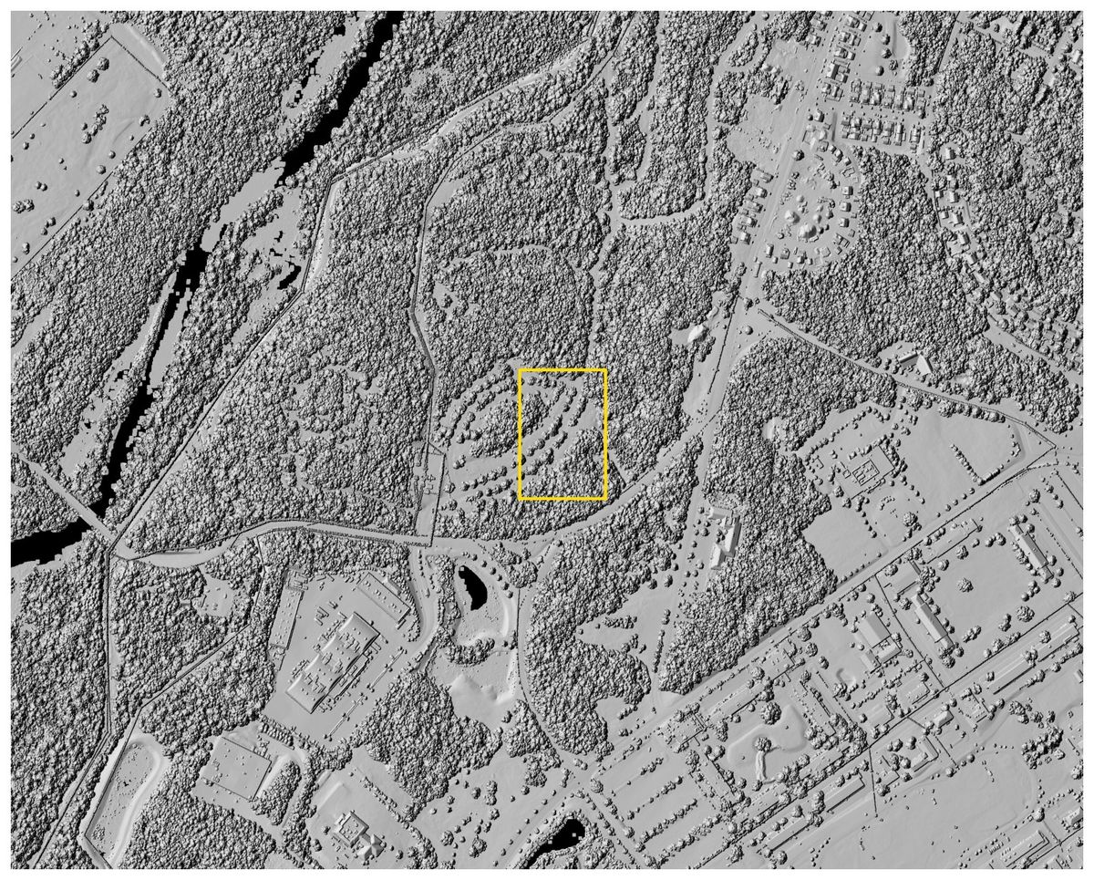
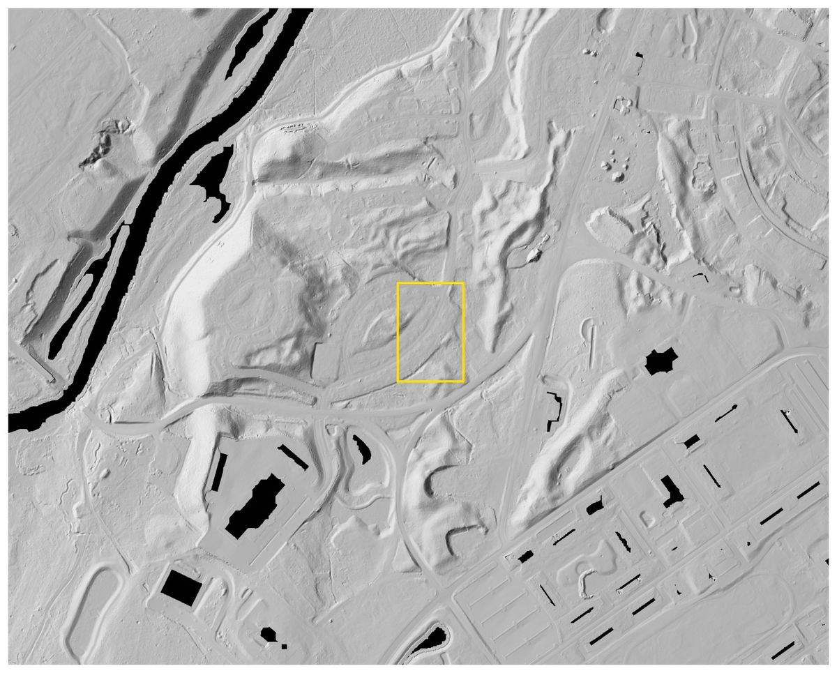
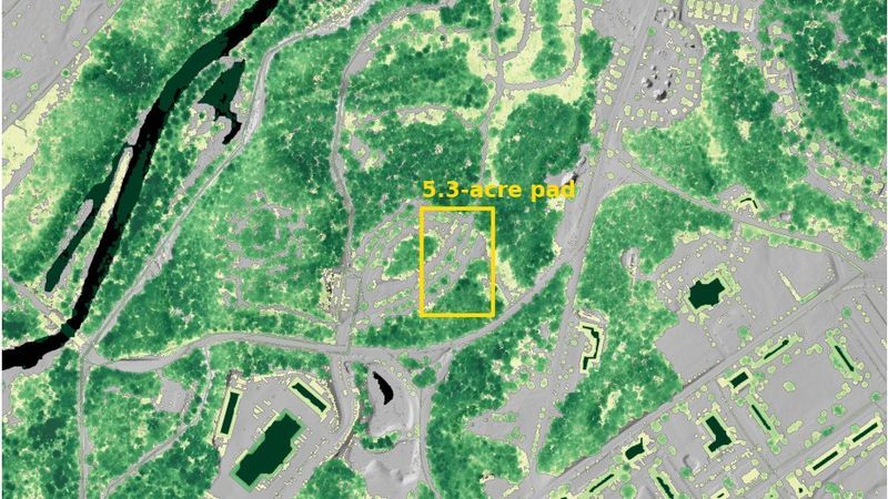
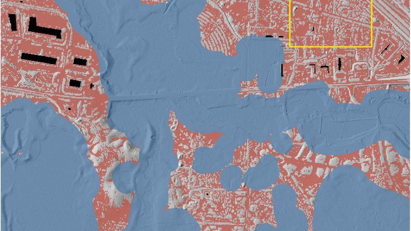
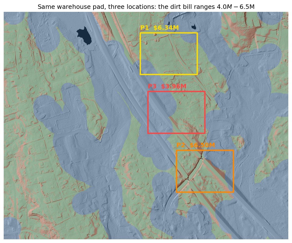
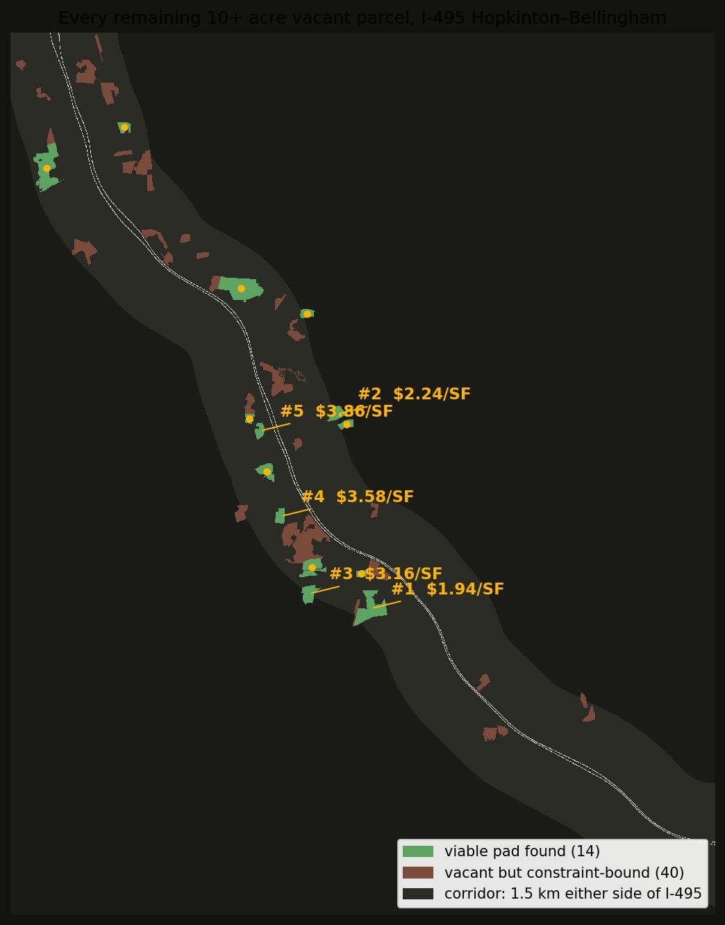
A camera sees treetops; lidar sees the ground. On wooded parcels that gap decides the budget, because a surface reconstructed from photographs counts the canopy as dirt. Lidar Site Studies is a four-part demonstration built entirely from public Massachusetts lidar, imagery, parcel records, and mapped wetlands, run through one repeatable screen: bare-earth DTM and canopy-surface DSM hillshades, a canopy height model, flow accumulation and a terrain wetness screen, slope and roughness, viewsheds, access-grade road profiles, and cut/fill earthwork against a conceptual pad. Devens compares the modeled ground against the campus that was actually built there, and shows the canopy hiding $5.6M of earthwork that never existed. Middleborough takes flat-looking wooded land and finds terrain wetness the mapped wetland layers miss, leaving 175 of 441 acres through the screen. Hopkinton places the same 16.3-acre pad three ways on one parcel and prices each — the same building lands $2.5M apart on terrain alone, and the ranking holds across the full $10–$40/yd³ unit-cost range. The I-495 corridor study runs every vacant parcel over ten acres within a mile of the highway across nine towns through the same screen: 54 in, 14 out, before anyone flies anything. The site publishes its method, sources, and limits alongside the results, states plainly that these are planning-level comparisons rather than surveys, delineations, or engineering products, and ships a dependency-free validation script and the scoring code that grades the depression and wetness screens against state vernal pool and DEP wetland data.
Result
Four studies that turn terrain into a decision: a canopy-driven $5.6M earthwork error caught at Devens, 441 acres screened down to 175 at Middleborough, a $2.5M pad-siting spread at Hopkinton, and a 54-parcel corridor list cut to 14 — all reproducible from free public data.
Figures