Overview
Welcome aboard
This summer we're exploring a real piece of local history: Black Sam Bellamy and the Whydah, wrecked off Cape Cod in the early 1700s. The name of this unit means two things at once. You'll learn the navigation tools and techniques pirates actually used to cross an ocean — reading maps, using the stars to find direction, and keeping track of how far and which way they sailed. And you'll navigate the real story of who these people were and why they made the choices they did.
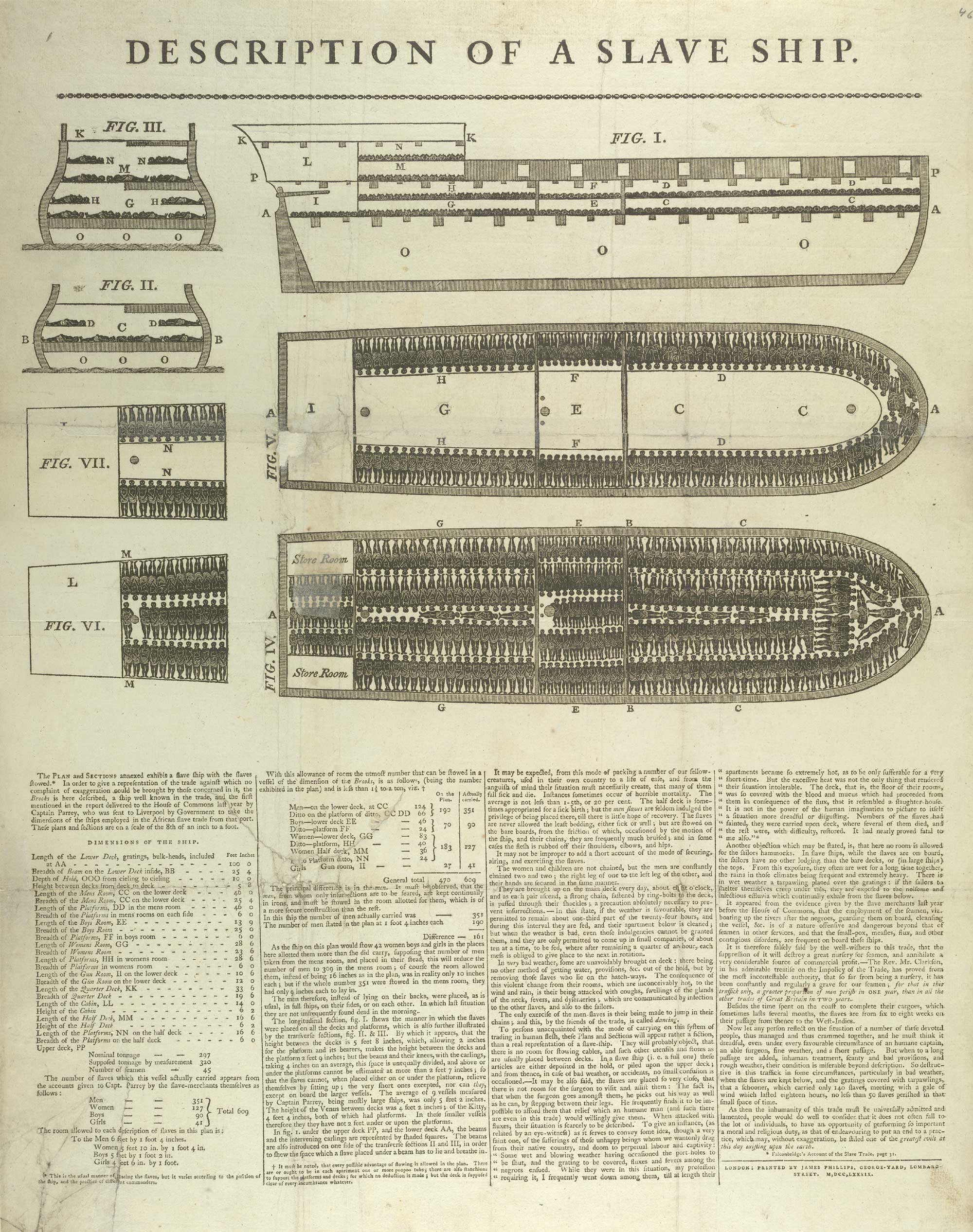
The Whydah Gally was a slave ship — one of the largest of her kind in 1717. In February of that year, a 28-year-old pirate named Sam Bellamy captured her off the Bahamas. Ten weeks later, on the night of April 26, she ran aground off Wellfleet in a midnight nor'easter and split apart. Of the 146 people on board, 144 drowned in less than fifteen minutes.
The wreck stayed buried under Cape Cod sand for 267 years. In 1984, a man named Barry Clifford found her using a chart drawn in 1717. The Whydah is the first authenticated Golden Age pirate shipwreck ever recovered — every coin, every bone, every piece of silver in the museum comes from someone who actually lived this story.
Over the next five weeks you'll spend time with the captain, the crew, the people they captured, the Salem minister who walked the condemned survivors to the gallows, and the cartographers whose maps stitched the whole thing together. You'll learn to read maps the way a pirate did — and you'll make your own. By the end, you'll pick one person from this story and tell it the way they would want it told.
Driving question
"Why would a person choose piracy in 1717 — and how would they want you to tell their story?"
Four supporting questions (one per week)
- How do people use maps and navigation to exercise power — in 1717 and today?
- What do Atlantic trade routes tell us about who benefits and who suffers from global commerce, then and now?
- How does geography shape the choices people can make — from 18th-century piracy to modern chokepoints like Suez, Malacca, and Panama?
- Whose stories get mapped, and whose get buried — across time?
Three threads running through the whole unit
- Cartography and navigation. Maps are the tool. We learn to read and make them first. The Whydah story holds together on cartography too: Cyprian Southack's 1717 salvage map is what Barry Clifford used in 1984 to find the wreck.
- The Whydah's Atlantic world. The ship's journey carries everything else: trade, slavery, piracy, the wreck, the recovery.
- Modern Oceans. Suez, Bab-el-Mandeb, Panama, Malacca, container shipping, the Houthi attacks. Same chokepoint logic as 1717, different water.
- Running through all three: a social justice lens - whose stories get told, whose get buried. Not a separate pillar; the constant theme across cartography, the Atlantic world, and modern oceans.
Holding the hard parts at the same time
The Whydah's crew were escaping real brutality and they stole for a living. The Ship's Articles were democratic and they were a mutiny. A Member of Parliament funded the ship as a slaver in the first place. None of these things cancel each other out. Your job is to hold all of them at once — without glorifying piracy and without flattening it into a costume.
Voyage Journal + final project
You'll keep a Voyage Journal across the whole unit — one entry per session, 16+ artifacts by Week 5 (maps, writing, analysis cards, sketches, character notes). Your final project is a new piece built from that Journal: you pick a perspective and a format (12 options), and cite at least 3–4 Journal entries as source material.
See the Final Project tab for the full format menu — twelve ways to tell your chosen person's story.
Field trips — three confirmed
- Field Trip 1 — Real Pirates Salem + Salem Maritime NHS rotation (Wed July 15): Two-section rotation. Section A morning at Real Pirates Salem, 285 Derby Street (Whydah scavenger hunt); Section B morning at Salem Maritime NHS (the Friendship replica East Indiaman + Derby Wharf + Custom House). Swap over lunch. Walking distance between sites. Curator-led at Real Pirates if scheduling allows.
- Field Trip 2 — Kayaking (Thu July 16): on-the-water "life at sea" day. A ~10-minute pre-paddle brief off the Why Piracy tab (the four 1717 ship types, frozen Navy wages, slave-ship crew mortality) — then students paddle, read the water, and feel the work behind dead reckoning.
- Field Trip 3 — Georges Island / Boston Harbor Islands (Thu July 23): Week-3 capstone trip. Boston Harbor as the gateway to the city where the Whydah's story ended — the harbor-approach islands, Nix's Mate's gibbet warnings, and Fort Warren as a later layer of harbor defense. See the Boston Harbor block on the Salem Connection tab.
Live - the same Atlantic, right now
For the 3D flythrough and live maps, head to the Maps & Flythrough tab. For latitude, longitude, and how flat maps lie, see Navigation & Projections.
Timeline — the Whydah's story
People
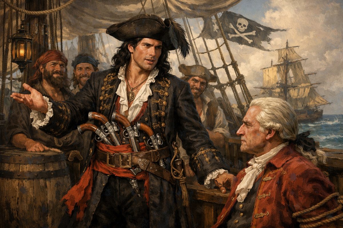
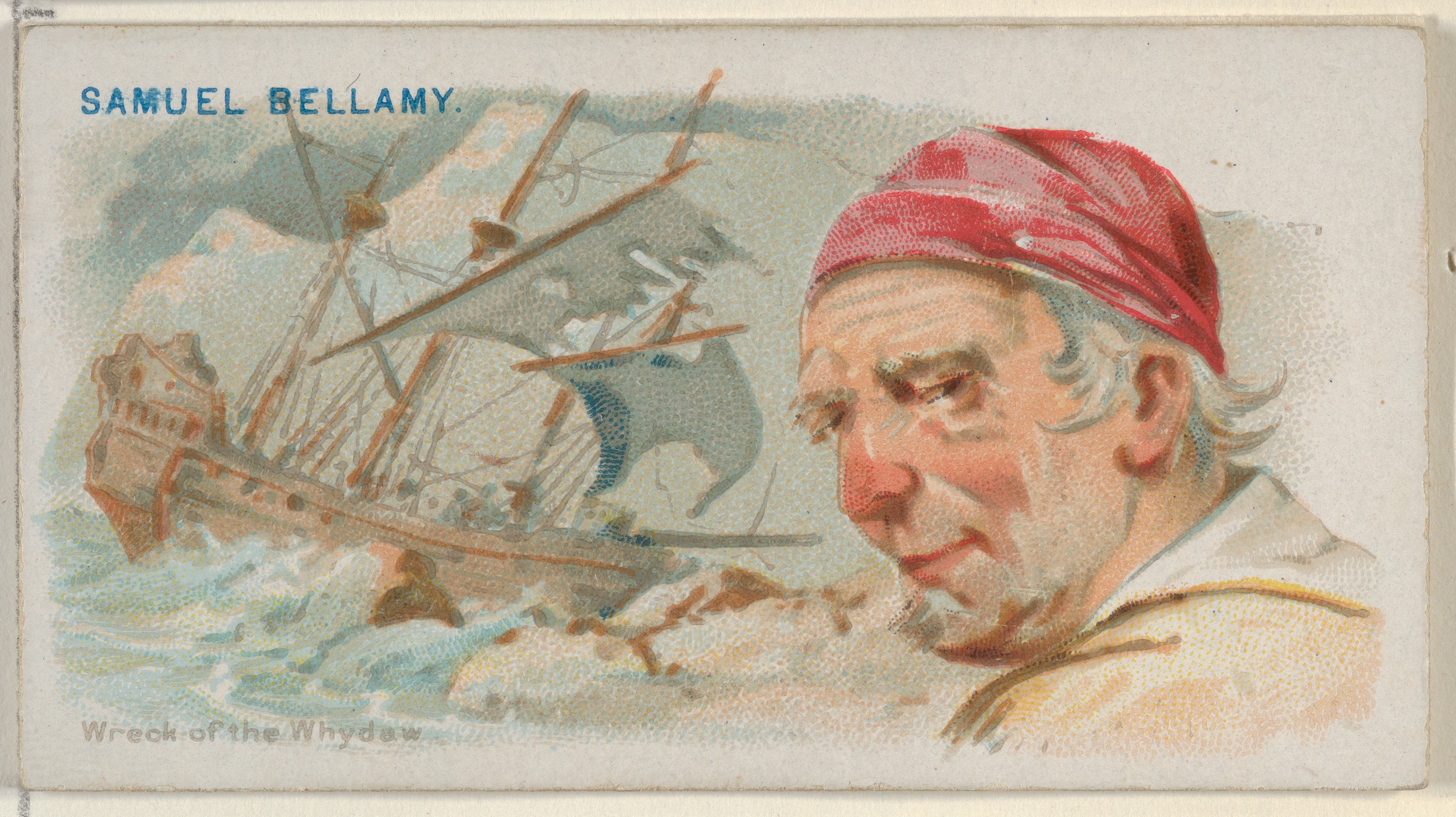
- Born Devon, England; mother died in his birth Solid (parish records: born c. late Feb 1689, baptized 18 March)
- Ship's boy at age 13 (~1702) and Royal Navy service — the traditional backstory, thinly documented (a 1716–17 deposition even calls him London-born) Contested
- Arrived at Cape Cod by 1714–early 1715 (the "Maria Hallett" name is a 1934 literary invention)
- Captured 53+ ships in ~1 year; died at 28 in the wreck
- Cruised with Paulsgrave Williams and French pirate Olivier La Buse through 1716; the plan on April 26, 1717 was to split (Bellamy to Cape Cod, Williams to Block Island) and regroup at Damariscove Island, Maine - the storm wrecked it
- Forbes (2008) ranked him the highest-earning pirate of all time at ~$120M in 2008 dollars - a record Guinness World Records confirmed in 2023
- Reputation for releasing captured crews with relatively little violence — real and somewhat mythologized by Johnson 1724
- Colin Woodard's framing: "Fight smart, harm few, score big"
- Half-Miskito Indian from the Mosquito Coast (Nicaragua/Honduras)
- Pilot of the Whydah at age 16
- One of only 2 Whydah crew to survive the wreck
- Never tried — likely because he was Indigenous — and sold into slavery Solid
- Probably the "Julian the Indian" bought by John Quincy of Braintree — great-grandfather of President John Quincy Adams. That Julian made repeated escape attempts, was sold to another owner, and was hanged in Boston on March 22, 1733 (about age 32) for killing John Rogers, the man pursuing him after an escape (per Provincetown Independent, 2025; period broadside). The identification is probable but not proven Contested
- 16 years from teen pilot to executed escapee — exactly the span of the wreck-to-death arc
- Named in the original Boston trial record as a pilot of the Whydah, alongside John Julian (via Dow & Edmonds 1923)
- That single mention is everything we know — no age, no origin, no fate
- A reminder of how much of the crew is anonymous in the documentary record
- Passenger on merchant sloop Bonetta with his mother (Jamaica → Antigua)
- Bellamy captured the Bonetta Nov 9, 1716; looted her for 15 days
- King demanded to join the pirates, threatened to kill himself if restrained, threatened his mother
- Died in the Whydah wreck, age at most 11
- Remains identified 2006: 11-inch fibula in a shoe and silk stocking
- Wealthy Rhode Island silversmith — class contrast to Bellamy
- Supplied the sloop; Bellamy supplied the nav skill
- Bellamy's quartermaster early in the partnership; by April 1717 he was captain of the sloop Marianne, Bellamy's consort — he was never the Whydah's quartermaster
- Survived the wreck by accident — stopped at Block Island to visit family while rest of fleet sailed on
- After the wreck he waited about two weeks at Damariscove, Maine for Bellamy — not knowing Bellamy was already dead — then sailed back to the pirate base at Nassau and kept raiding
- Accepted the 1718 royal pardon — then returned to piracy around 1720, sailing under Olivier Levasseur (La Buse)
- Then he simply vanishes. No capture, no trial, no execution, no grave — Williams is one of the very few Golden Age pirates whose ultimate fate is genuinely unknown Contested
- The other Whydah crew member to survive the wreck
- Claimed he had been forced into piracy
- Acquitted at the Boston trials and freed
- Experienced slaver who sailed the Whydah in 1716
- Delivered 312 of 367 captives alive to Jamaica
- Surrendered to Bellamy Feb 28, 1717 after a 3-day chase
- Bellamy let him and his crew go — gave them the Sultana
- Master of the Irish-flagged wine pink Mary Anne, captured by Bellamy off Nantucket the morning of April 26, 1717
- Cargo: ~7,000 gallons of Madeira
- Transferred to the Whydah as a prisoner — drowned in the wreck the same night (Davis deposition, Trials p. 318)
- His brother-in-law James Dunavan and cook Alexander Mackonachy were aboard the Mary Anne when she also wrecked — they survived
- One of the seven pirates Bellamy put aboard the Mary Anne as prize crew on April 26, 1717
- Threatened to shoot cook Alexander Mackonachy in the head when Mackonachy tried to steer the ship off course (Dunavan deposition)
- Mackonachy went on to inform local authorities, leading to the pirates' arrest at Eastham
- Hanged at the Charlestown gallows, November 15, 1717
- Boston attorney appointed by the Vice-Admiralty Court to represent all seven Mary Anne pirates
- Resigned in protest after his motions were denied — including a motion to admit Davis's testimony in the Mary Anne pirates' favor (Trials, pp. 297, 299)
- The illiterate pirates then defended themselves; six were convicted and hanged
- Cape Cod local; one of the few Wellfleet residents we can name from the immediate aftermath
- Sheltered Davis and Julian (the only two Whydah survivors) when they came ashore on the morning of April 26, 1717
- Then went down to the beach to scavenge from the wreck — the first documented Cape Cod "moon-cusser" plunderer of the Whydah, before Southack arrived from Boston
- Cyprian Southack later wrote that Harding was "as Gilty as the Pirates saved" (Dow & Edmonds 1923)
- Named in the Trial depositions
Where did the Black crew come from?
Roughly a quarter of Bellamy's crew — up to 50 men — was of African or African-descended origin (Kinkor's research). Here's the part that surprises people: the Whydah had already delivered the enslaved Africans she carried to Jamaica before Bellamy ever captured her. So her Black crew didn't come from the Whydah's own hold — they came from the other ships Bellamy took.
Many had been enslaved on Caribbean plantations or aboard slave ships, and seized piracy as a way to free themselves. When Bellamy captured a slave ship, the captives could join the crew or be set free with one of his spare vessels — and many joined: in one capture of a “Guinea ship,” about 25 enslaved men signed on at once. Aboard, they got an equal share of the loot and could hold skilled jobs — the ship's pilot, John Julian, was a 16-year-old of Miskito (Central-American Indigenous) descent.
- Member of Parliament
- "The foremost London slave merchant of his day"
- Commissioned the Whydah's build in 1715 as a slaver
- Evidence that British slavery was a government-connected enterprise, not a distant private affair
- "New England's first native chart maker"
- Commander of the Bay Colony's naval militia
- Sent by Gov. Samuel Shute in 1717 to salvage the wreck; recovered almost nothing
- Marked the wreck's location on his New England chart
- That 267-year-old map is how Barry Clifford found the Whydah in 1984
- Discovered the wreck in 1984 using Southack's map
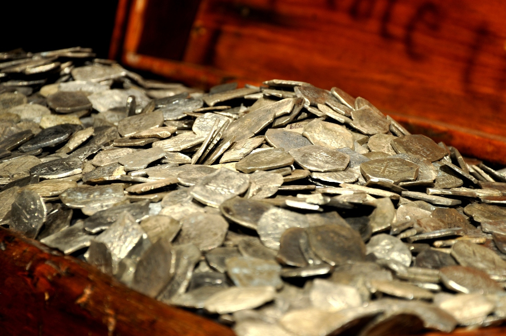
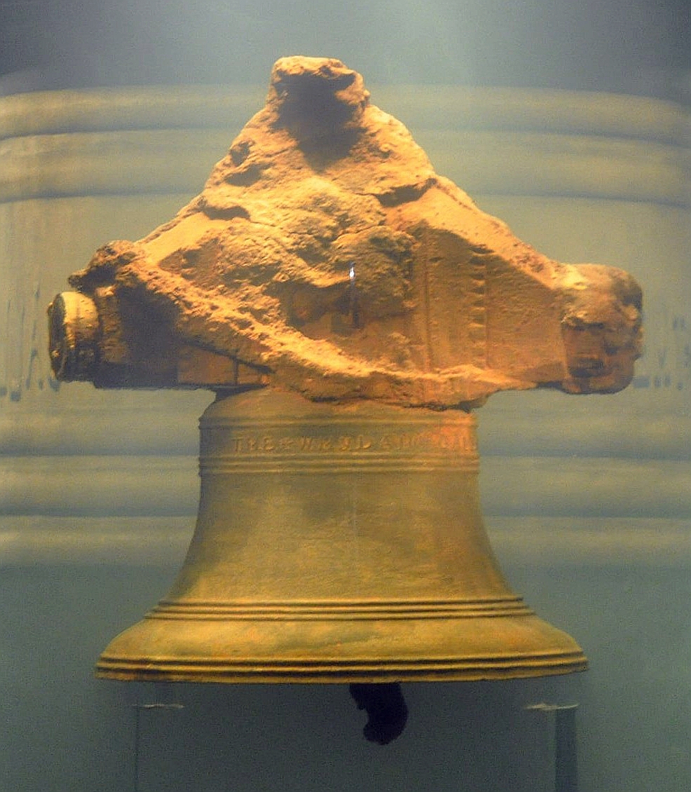
- Recovered the bell in 1985 — first authenticated Golden Age pirate wreck
- Has led the excavation via Expedition Whydah ever since
- Some controversy in archaeology community about salvage vs. academic methods
- Joined Expedition Whydah 1986; 27 years as Director of Research
- Compiled the Whydah Sourcebook
- Established that ~25% of Bellamy's crew was Black
- Co-authored Real Pirates: The Untold Story of the Whydah (with Clifford & Simpson)
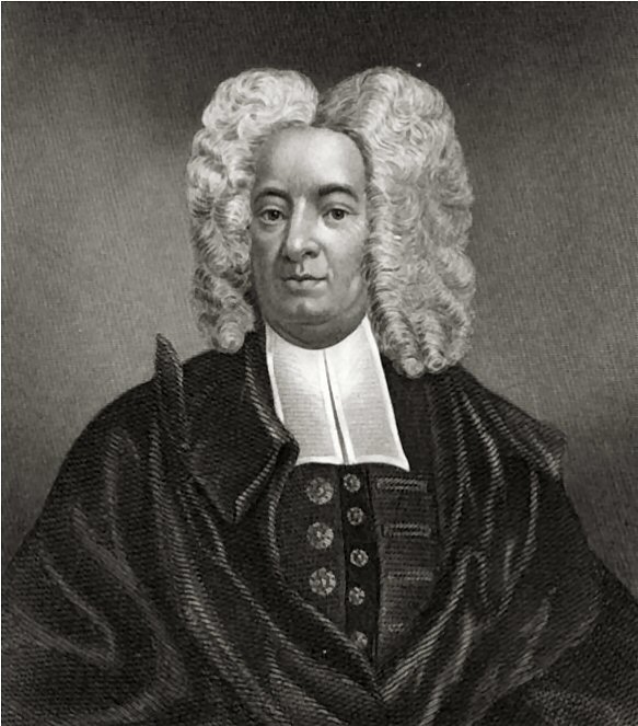
- Son of Increase Mather, grandson of Richard Mather
- Complicated role in the 1692 Salem Witch Trials — his Wonders of the Invisible World defended the court
- Ministered to the Whydah pirates in Boston jail
- On Nov 15, 1717 took "a long and sad walk" with the six condemned men from the prison to the gallows at the Charlestown Ferry landing (his diary, quoted by MHS)
- Published the execution sermon as "Instructions to the Living, from the Condition of the Dead" (1717) — an existing primary source
- He is the documented Salem→Boston bridge — the Salem-known name who verifiably appears in the Whydah's ending
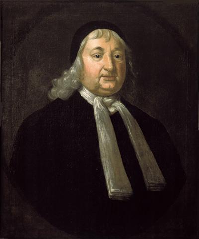
- One of the 1692 Salem Witch Trial judges
- In 1697 published a public apology for his role — the only Witch Trial judge to do so (Sewall's apology) Solid
- Long linked to the Whydah pirate trials in popular accounts — but the primary trial record, The Trials of Eight Persons (1718), does not name him among the commissioners at any of the four October 1717 sessions. (His wife died mid-trial, Oct 1717.) So we can't say he was one of the judges — the documented Salem→Boston bridge is Cotton Mather.
- The affair is documented; the name has been contested for decades
- Elizabeth Reynard's 1934 novel The Narrow Land popularized the name "Maria"
- Ken Kinkor's archival research found a young woman of that name was actually living in Eastham at the time (per Colin Woodard, Republic of Pirates, 2007), but a direct documentary link to Bellamy is not proven
- Local folklore also calls her the "Witch of Wellfleet"
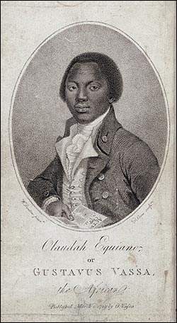
- Author of The Interesting Narrative of the Life of Olaudah Equiano (1789)
- Captured 1756 — NOT Whydah-era (his narrative is 40 years after the wreck)
- Used as a Middle Passage voice, not a Whydah voice
- Scholarly debate about African vs. American birth
The Pirate World
The wider pirate world
- Former privateer; organized Nassau as a pirate haven ~1715
- Mentored both Bellamy AND Blackbeard aboard the Marianne
- Deposed summer 1716 — his crew voted him out because he refused to attack English ships
- Took the King's pardon from Governor Woodes Rogers in 1718 and switched sides — became a pirate-hunter chasing his own former comrades. Late in 1719, hunting pirates across the West Indies, his ship was caught in a hurricane and wrecked on a reef; he drowned. A few of his men escaped in a canoe.
- Served under Hornigold alongside Bellamy
- Captured La Concorde → renamed Queen Anne's Revenge, 40 guns, 300 crew
- Blockaded Charleston 1718
- Killed at Ocracoke NC, Nov 22, 1718 — 19 months after Bellamy
- Deliberately cultivated terrifying image (fuses in beard)
- French pirate operating jointly with Hornigold and Bellamy in late 1716 (Davis deposition, Trials p. 318; Brown deposition)
- His sloop Postillion + Bellamy's Sultana together captured the merchant ship St. Michael in December 1716, taking Welsh carpenter Thomas Davis as a forced man
- Held captives at the island of Blanco; transferred them to Bellamy's ship in January 1717
- Drops out of the record after early 1717
- The key cast member missing from most popular accounts of Bellamy's career
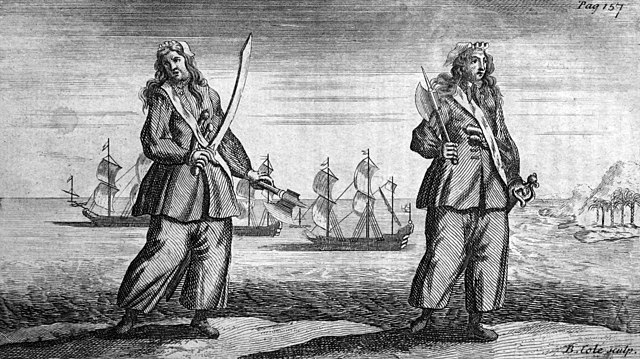
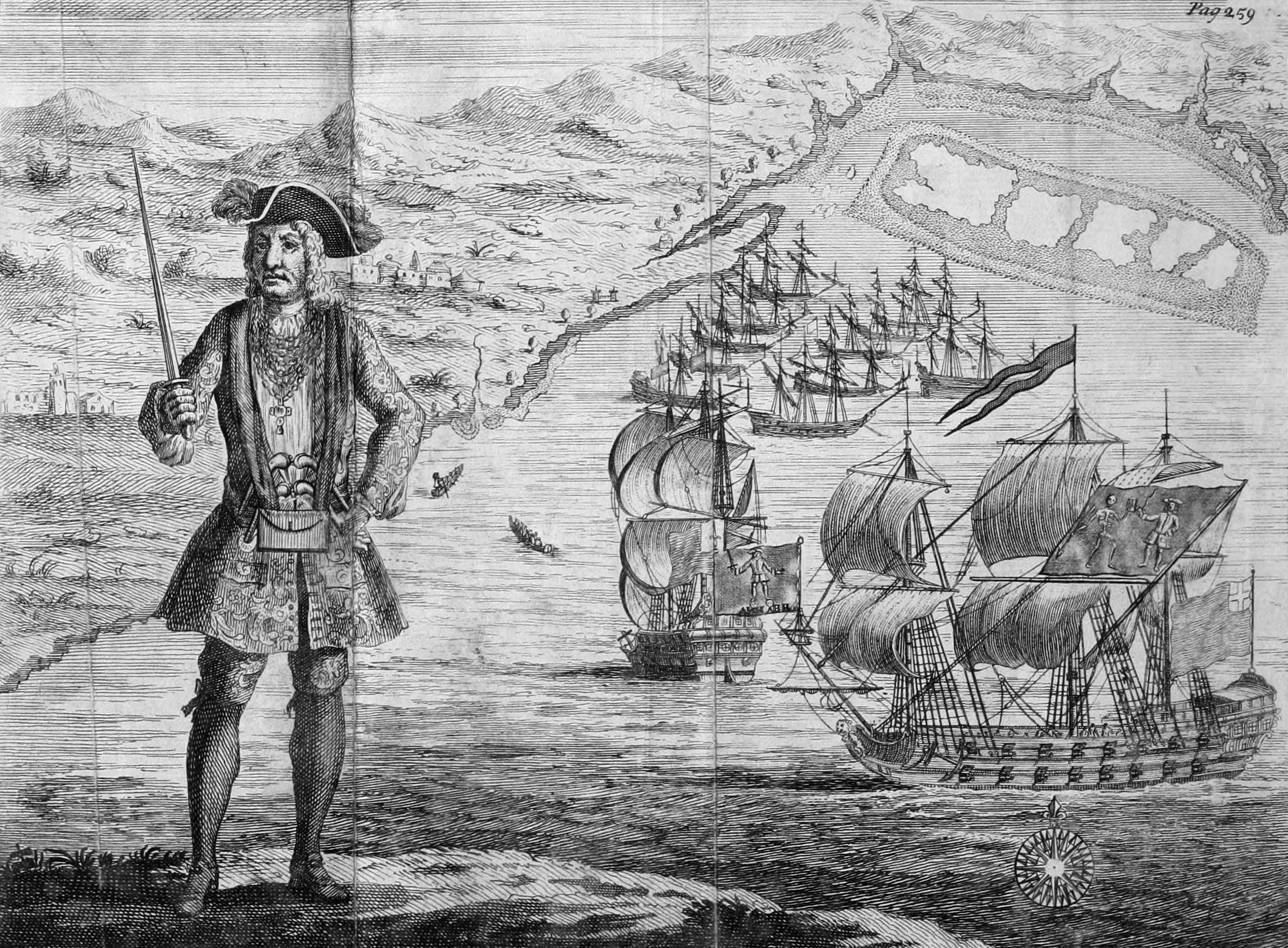
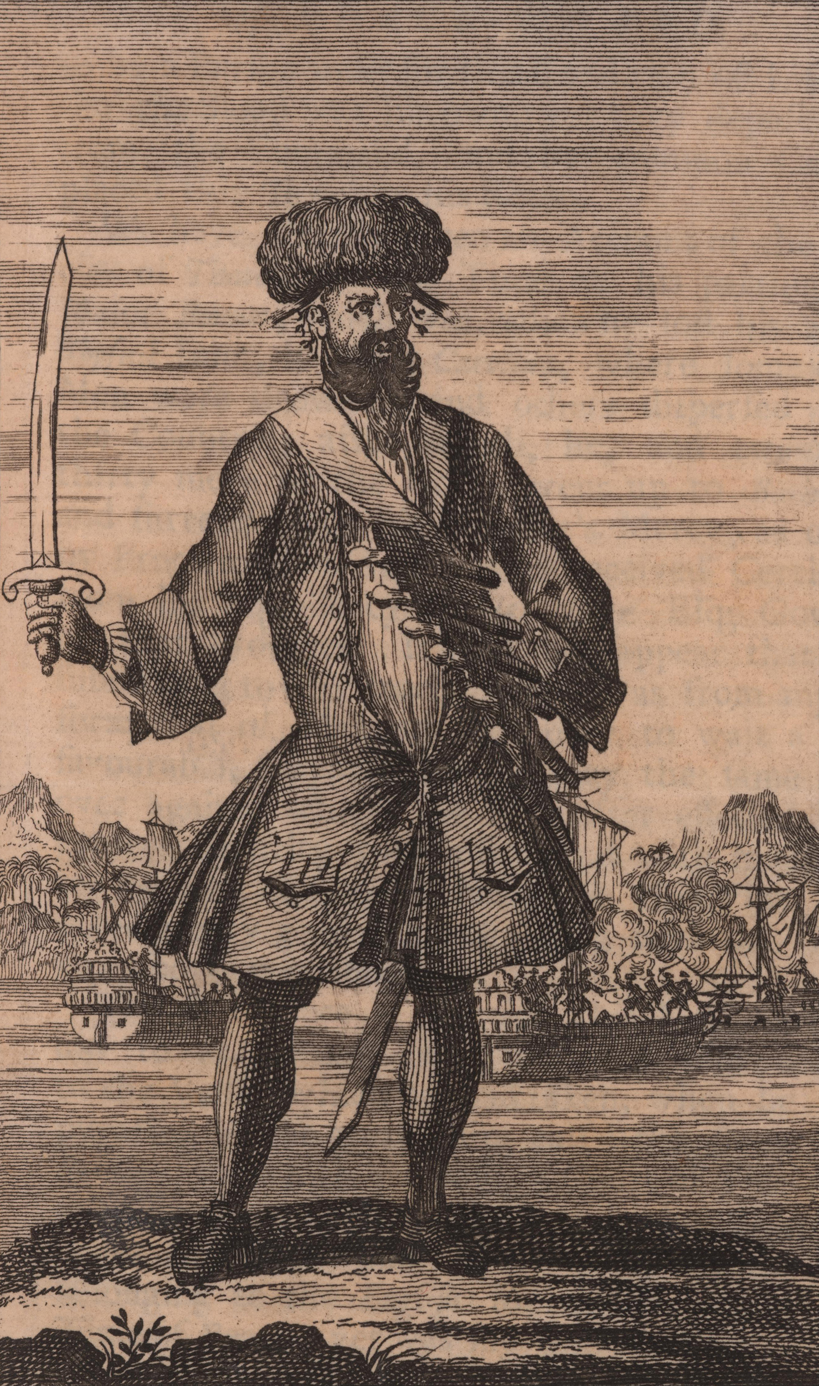
Other Golden Age figures - visual primary sources from 1724

The Wreck & Fleet
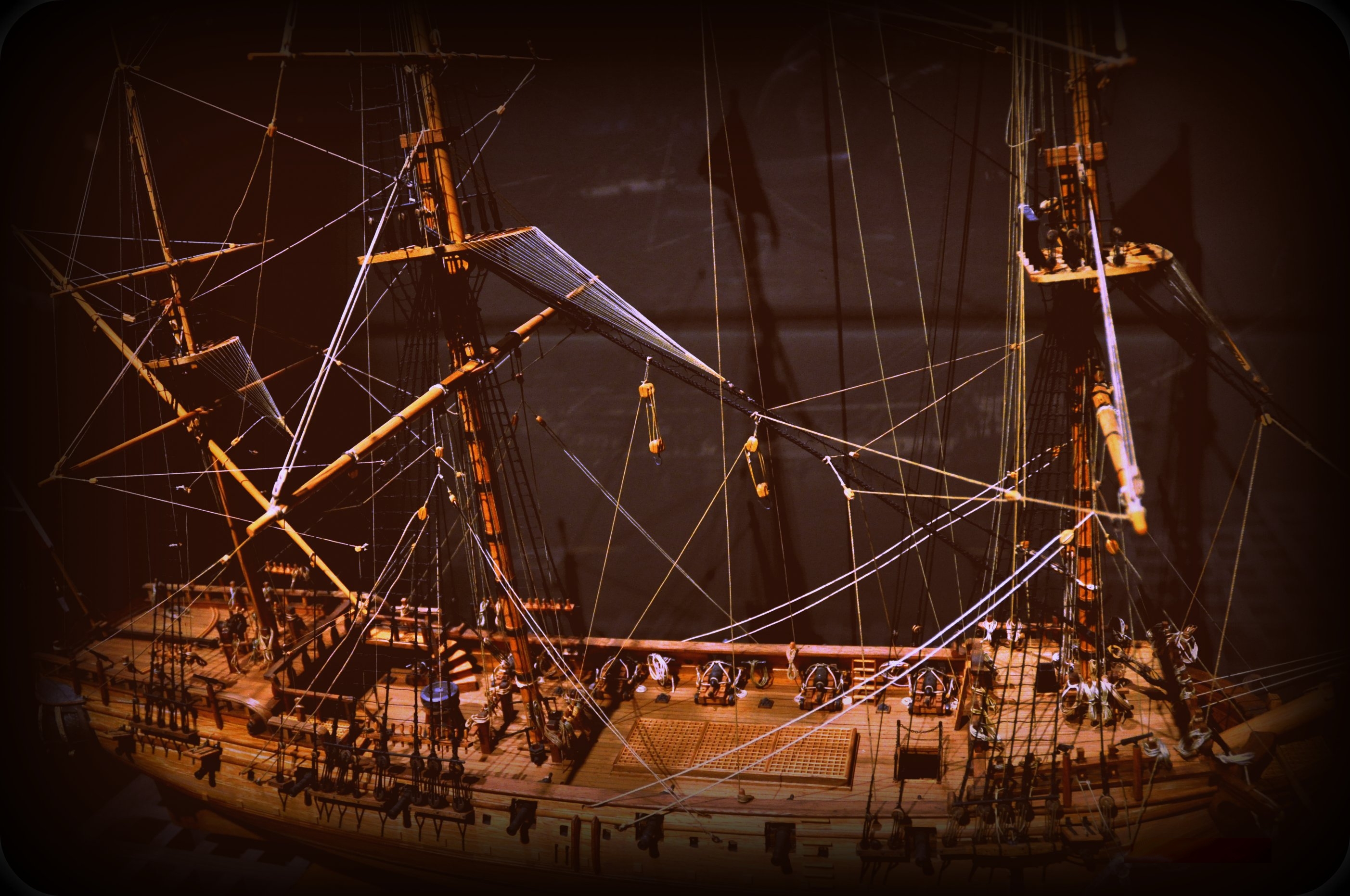
The fleet - Bellamy's four ships on April 26, 1717
| Ship | Role | Captain | Fate |
|---|---|---|---|
| Whydah | Flagship, 28+ guns | Sam Bellamy | WRECKED at Wellfleet · 2 survivors of 146 aboard |
| Marianne | 10-gun sloop (Hornigold's old ship) | Paulsgrave Williams | Survived · Williams at Block Island visiting family |
| Anne Galley | Captured consort | Richard Noland (former quartermaster) | Separated from fleet; survived |
| Mary Anne (pink) | Prize captured the same day, April 26 — loaded with Madeira wine | Bellamy's prize crew of 7 | Also wrecked April 26, south of Whydah · all 10 aboard survived (shallow wreck) |
The "7 additional survivors from a sloop" often referenced are the Mary Anne's prize crew (7 pirates Bellamy had put aboard that afternoon) plus 3 original crew, of whom all 10 made it ashore when she wrecked in shallower water.
What we can do with this in class
Four ships in one storm. Two survived. Williams was at Block Island visiting family, so his sloop got out. The Anne Galley got separated and survived. The Mary Anne wrecked too but in shallower water, so all 10 aboard walked off. Bellamy's Whydah took the worst of the wind on a lee shore at Wellfleet, with the 16-year-old pilot John Julian aboard (that he was at the wheel that night is period-plausible inference — "pilot" is what the record documents) and no way to know their east-west position. Two of 146 survived. The wreck wasn't one event — it was four parallel outcomes in the same storm.
The other reason the wreck happened on this coast — Hanna's "hostile shore" framing.
Mark G. Hanna (Pirate Nests, 2015; Piracy in Colonial North America, 2020) adds a money-and-politics explanation alongside the navigational one. Through the 1690s and into the early 1700s, ports from Newport to Boston to Charleston quietly tolerated and profited from "their" pirates — fencing prizes, refitting ships, looking the other way. Then the Treaty of Utrecht (1713) ended the war, the new Piracy Acts arrived, and royal officials began enforcing them in the colonies. By April 1717 Bellamy was attacking the very New England coast that, fifteen years earlier, would have welcomed him as a supplier of contraband and silver. The wreck happened not just because the longitude problem was unsolved, but because the towns that once welcomed pirates had turned against them. The same Cape Cod that had previously been a market was now a hostile shore — and the surviving crew were tried in a Boston that had only just decided pirates were the enemy.
Primary-source spotlight — the survivors' own depositions
🖨 Try it: read one of these depositions like a historian →
Thomas Davis on the wreck (Trials, p. 318)
"The Ship being at an Anchor, they cut their Cables and ran a shoar, in a quarter of an hour after the Ship struck, the Main-mast was carried by the board, and in the Morning She was beat to pieces. About Sixteen Prisoners drown'd, Crumpstey Mast of the Pink being one, and One hundred and forty-four in all."
Two things in this quote rewrite the popular story. (1) The Whydah was anchored when the storm hit — Bellamy's crew deliberately cut their own cables to try to beach her, rather than being driven uncontrolled onto the bar. (2) Captain Andrew Crumpstey of the Mary Anne was aboard the Whydah and drowned — primary confirmation, ending earlier ambiguity about his fate.
Peter Cornelius Hoof on the treasure (Trials, p. 319)
"The money taken in the Whido, which was reported to Amount to 20000 or 30000 Pounds, was counted over in the Cabin, and put up in bags, Fifty pounds to every Man's share, there being 180 Men on Board… Their Money was kept in Chests between Decks without any guard, but none was to take any without the Quarter Masters leave."
- £20,000–30,000 sterling — Hoof's eyewitness figure, counted out in the cabin; the one treasure number that comes from someone who actually saw it. You'll also see “4½ tons of gold and silver” repeated everywhere online — that’s a modern retelling, not the 1717 record. A separate colonial document says Bellamy had grabbed roughly 400,000 pieces of eight from two Jamaica-bound ships just before the wreck. Only about 10% of the estimated treasure has been found since 1984.
- £50 per man, even share — primary-source confirmation of Bellamy's flat distribution. The pirate-democracy claim has at least this much documentary support.
- 180 men aboard at division vs. 146 at the wreck — the gap is prize-crew attrition, men placed on captured vessels in the weeks before the storm.
- Treasure stored in chests between decks, unguarded, but governed by the Quartermaster's authority — not by force.
James Dunavan on the Mary Anne pirates and the Common Prayer Book (Trials)
"…the Pinks Company could not see the Shoar till they were among the Breakers… the Prisoners at the Bar or some of them… Cryed out saying, For God's sake let us go down into the Hould & Die together. And the whole pinks Company tarry'd on Board her all that Night: And in their Distress the Prisoners ask'd the Deponent to Read to them the Common-Prayer Book…"
Two notable additions. (1) The Mary Anne pirates — facing storm, shore, and certain capture — asked to die in the hold together, then asked their captives to read them Anglican prayer through the night. Useful for any session on what pirates actually believed about death and dying. (2) The deposition lists three vessels visible before grounding ("the Pirate Ship, Snow and Sloop") — Bellamy's fleet at the moment of the storm was at least four vessels (Whydah + Anne Galley snow + Mary Anne pink + Fisher sloop), corroborating the four-ships table above.
Artifacts → sessions
Why piracy — push/pull causal map
Privateer vs. pirate — the line was a piece of paper
Same work: chase a ship, board it, take the cargo, fight if you have to. The only real difference was a government license called a letter of marque.
Carries a letter of marque from a king or government. Attacks enemy ships, in wartime only. Takes captured ships (“prizes”) to a prize court to be sold legally. A patriot on paper.
No license. Attacks anyone, war or peace. Keeps the loot. A criminal who could be hanged. The Whydah’s crew were here.
Push Factors — away from alternatives
Pull Factors — what piracy offered
Read it yourself: a real pirate crew's Articles
The Whydah's own Articles didn't survive — but we know the crew had a set, because trial testimony confirms it. (A wounded-heart symbol appears among crew engravings found on the wreck, but it isn't proof of the signing.) The closest surviving example comes from Bartholomew “Black Bart” Roberts’ crew, written down in 1724. Here they are, in plain English:
- Every man gets a vote on important decisions, and an equal share of the fresh food and drink.
- Everyone takes a fair turn at captured goods. Cheating the company → being marooned (left alone on a deserted island).
- No gambling for money with cards or dice.
- Lights and candles out by eight at night.
- Keep your weapons — gun, pistols, and cutlass — clean and ready for service.
- No boys or women allowed aboard. (Smuggling a woman on in disguise was punishable by death.)
- Deserting the ship, or your post in battle, → death or marooning.
- No fighting each other on board; settle quarrels on shore, with sword and pistol.
- Nobody quits until each man has earned £1,000. Lose a limb in service and you get 800 dollars from the common fund; smaller injuries paid in proportion.
- The captain and quartermaster get 2 shares of a prize; the master, boatswain, and gunner 1½; other officers 1¼; everyone else 1.
- The musicians get the Sabbath (Sunday) off; the other six days, only by special favor.
And one more anti-romantic fact. Pirates significantly disrupted the Atlantic slave trade in the 1710s–20s — enough that European powers made wiping out piracy a top priority. But the slave trade rebounded: by the 1730s it had doubled compared to the late 1710s/20s peak of piracy. Pirates interrupted; they didn't stop. We hold all of these halves.
Salem connection
Salem's own maritime economy
Salem was built on the same trade the Whydah sailed through.
From the mid-17th century onward, Salem merchants provisioned West Indies plantations with dried cod, livestock, and lumber; Salem ships returned with sugar, molasses, rum, and coffee. The National Park Service is explicit that Salem's waterfront economy depended on slavery.
Even after Massachusetts abolished slavery in 1783, Salem merchants continued in the slave economy — Joshua Ward's Brig Favorite made a slaving voyage to Africa in 1786.
The Ward Family Papers at Peabody Essex Museum document this directly.
Donnan 1930 names names: Elizabeth Donnan's archival study (The New England Quarterly 3, no. 2) identified Salem as "the most active of the Massachusetts ports" in the post-Revolutionary slave trade. Documented Salem slavers include Joseph & Joshua Grafton (the brigs Favorite and Gambia); George Crowninshield (the Polly and Sally, 1787); the Abeona (Sinclair & Waters, 90 enslaved Africans, 1791 — sued by Stephen Cleveland, fined £4,500); Capt. Fairfield, killed by enslaved people aboard the Felicity, 1789. Rev. William Bentley's diary (Sept 22, 1788 onward) records illicit Salem slave voyages and his frustration that "there is not one man of spirit to stand forth and make enquiry." A Salem-to-Charleston-to-West-Africa pipeline ran East Indian textiles ("Blue Guineas" / "Salempores") through Charleston, where they were bartered for enslaved people. The infrastructure didn't end with the Revolution — it ran through 1808 and arguably beyond. Solid
Philip Ashton — Marblehead fisherman, pirate captive, Salem rescue (1722–1725)
The other North Shore pirate story.
In June 1722, Philip Ashton, a young fisherman from Marblehead (Salem's immediate neighbor), was fishing off Nova Scotia when his vessel was captured by Edward "Ned" Low — one of the most violent Golden Age pirates, born in Boston. Pressed into Low's crew, Ashton finally escaped on Roatán Island in the Bay of Honduras, where he survived nearly two years almost entirely alone — a real-life Robinson Crusoe. He was rescued by a brigantine from Salem and walked through his parents' front door in Marblehead in 1725; they thought he had risen from the dead. He published his story (Ashton's Memorial, 1725) and it became a colonial sensation.
Salem's privateering tradition
Salem was a privateering hub. During the Revolution, Salem captains held more than 150 privateer commissions from the Continental Congress and the Massachusetts state government. They captured at least 445 British vessels. Hawkes House at Derby Wharf served as a prize warehouse - cargo seized from British ships came in there before going to auction.
This is a hundred years after the Whydah, but it's the same waterfront and the same mechanic: a piece of paper from a government turns "piracy" into "patriotic service." When students walk Derby Wharf on FT1 (Section B), they're walking the same wharf where prize cargo got tallied.
Salem Maritime National Historic Site
- America's first National Historic Site
- Derby Wharf — built 1762, extended 1806, nearly half a mile long
- Interprets three eras at the same site: Triangle Trade colonial period · Revolutionary privateering · post-independence Far East trade
- Hawkes House was used as a privateer prize warehouse during the Revolution
- Walking distance from Collins MS - half of our Field Trip 1 rotation (Section A at Real Pirates Salem, Section B here at the Friendship + Derby Wharf, swap mid-day)
Peabody Essex Museum
- Major collection of early American maritime art + Asian art from the China trade
- Holds the Ward Family Papers and other primary documents on Salem's slave-trade involvement
- Could potentially host a research visit or provide digitized primary sources
The Salem names in the Whydah's Boston ending
Two names you may already know from Salem — one documented, one contested.
Cotton Mather — Puritan minister with a complicated role in the 1692 Salem Witch Trials. Twenty-five years later, he ministered to the Whydah pirates in the Boston jail, preached their execution sermon, and published Instructions to the Living, from the Condition of the Dead (1717), which still survives. He had a template for it: his 1699 collection Pillars of Salt: An History of Some Criminals Executed in this Land for Capital Crimes set up the execution-sermon-as-public-warning genre, which he applied to the Whydah pirates eighteen years later. The pamphlet is a primary source — and at the same time a piece of public-warning propaganda. Mather's diary entry six days after the hangings makes the commercial motive plain: "May not I do well to give the Bookseller, something that may render the Condition of the Pirates, lately executed, profitable?"
Judge Samuel Sewall — one of the 1692 Salem Witch Trial judges. In 1697 he published a public apology — the only judge to do so. He is long linked to the Whydah pirate trials in popular accounts, but the primary trial record, The Trials of Eight Persons (1718), does not name him among the commissioners — so we can't say for certain he was one of the judges. Contested
The same New England religious and legal establishment that ran the Salem Witch Trials in 1692 sat over the Whydah pirate trials in 1717 — same buildings, same law, and in Cotton Mather's case, verifiably the same name. The Whydah story happens in Salem too — twenty-five years after the witches.
Boston Harbor — where the story ended (Field Trip 3, Thu Jul 23)
Georges Island / Boston Harbor Islands — the pirate story's physical ending.
The Whydah wrecked off Cape Cod, but the people — the nine survivors — ended up in Boston, on trial for their lives. Boston Harbor is the gateway to the city where the Whydah's story ended, and FT3 rides out into it. Four things to hold, tiered:
- Solid The Whydah's crew were tried and hanged in Boston. Nine of Bellamy's men survived that night (2 from the Whydah + 7 from the Mary Anne). Six were convicted of piracy and hanged on November 15, 1717 at the Charlestown Ferry gallows, on the tidal mudflats "within the flux and reflux of the sea"; two were freed; John Julian (the 16-year-old pilot) was sold into slavery. Cotton Mather — the Salem-known minister — ministered to the prisoners and walked with them to the gallows. He is the documented Salem→Boston bridge.
- Solid The harbor islands were a warning. Every ship sailing into Boston had to pass small islands like Nix's Mate, where the law let authorities hang a convicted pirate's body in an iron cage — a gibbet — for months, so every arriving sailor saw what happened to pirates. The best-documented case is the pirate William Fly, gibbeted on Nix's Mate in 1726. Keep the two stories distinct: the Whydah men were hanged at the Charlestown Ferry in 1717; the caged pirate on Nix's Mate is William Fly, nine years later.
- Solid Fort Warren is a later layer. The big stone fort on Georges Island was begun in 1833 — Civil-War-era, not pirate-era. Read the harbor in layers: in 1717 the "defense" was geography plus gibbet warnings; by the 1800s, stone walls; today, shipping lanes.
- Mythologized The Nix's Mate "curse" — the tale that the island keeps shrinking to prove a hanged man's innocence — is folklore. A fun story; not history.
Salem Harbor right now
Live ship tracking from MarineTraffic.com. The same harbor that ran the triangle trade in 1717 — what's moving through it today?
Maps & Flythrough
A 19-stop, 3D globe flythrough of the Bellamy story, from his birthplace in Devon to the modern Salem museum. Each stop shows a photo and a "why this matters" caption while the camera does a slow 180-degree pan around the location. Hit play to start, or jump to any stop via the "All stops" button.
How this was custom-built - a GIS teaching artifact
1. Coordinates from primary sources. Every one of the 19 stops has a real lat-lon pulled from the research-findings reference. Some are documented to within a few meters (Old State House: 42.359N, 71.058W). Others are approximate by necessity. The Whydah wreck site is given as the publicly cited area off Marconi Beach because the exact coordinates are restricted under Clifford's federal salvage permit.
2. The map engine - MapLibre GL JS. The 3D globe is rendered with MapLibre GL JS, a free and open-source rebuild of Mapbox GL JS after Mapbox went proprietary in 2020. No API key, no signup, just a 250 KB JavaScript library included in the page.
3. The satellite imagery - Esri World Imagery. The Earth's surface comes from Esri's World_Imagery tile service - a stitched mosaic of Maxar, USGS, NASA, and aerial sources. Free for educational use, no API key required for raster tiles.
4. The camera animation. Each transition between stops uses three animated phases: a 2.5-second zoom-out arc to the geographic midpoint between stops (so students see the spatial relationship), a 3.5-second smooth flyTo into the next location with arrival pitch and zoom tuned per spot, then a 15-second slow 180-degree pan around the destination. The pan is driven manually frame-by-frame because MapLibre's built-in flyTo normalizes bearings to take the shortest path - 0 to 359 degrees collapses to -1 unless you drive setBearing yourself.
5. The captions. Photos and "why this matters" descriptions are HTML and CSS overlays that fade in and out with each stop. Photos reference the pics/ folder via relative paths so the same file works locally and on github.io. Each caption has a stop-number label, location name, subtitle, body text, and citation footer.
6. The waypoints data. All 19 stops are stored as a JavaScript array near the top of flythrough.html. Each entry has lng, lat, zoom, pitch, name, subtitle, description, image, meta. Editable in any text editor. Students can add their own stops as a research extension, reorder them, or rewrite descriptions.
The 19 stops
| # | Location | Coords | Why this hinges the story |
|---|---|---|---|
| 1 | Hittisleigh, Devon, UK | 50.745N 3.823W | Devon was 18th-century England's nursery for the Royal Navy. Bellamy's path to sea was set the day he was born here. |
| 2 | London | 51.510N 0.099W | London capital funded the slave-trade economy. The Whydah was destined for triangle-trade work the day she was launched here. |
| 3 | Ouidah, Benin | 6.36N 2.09E | 367 enslaved Africans taken aboard. The human source of the wealth Bellamy will later steal. |
| 4 | Kingston, Jamaica | 17.94N 76.84W | 312 of 367 enslaved people sold here, 55 dead in the Middle Passage. The treasure Bellamy later takes is the proceeds of human sale. |
| 5 | Sebastian Inlet, Florida | 27.86N 80.45W | The pivot of Bellamy's life. He came as a legal salvager and left as a pirate. Without 1715's hurricane, no Bellamy career. |
| 6 | Nassau, New Providence | 25.04N 77.35W | The political home of pirate democracy. Where ~90 men actually voted Bellamy into command. |
| 7 | Windward Passage | ~20.0N 73.5W | Career peak. From here Bellamy commands the largest, richest pirate flagship of the entire Golden Age. |
| 8 | Block Island, RI | 41.18N 71.58W | The fleet splits here. Williams' detour to visit family accidentally saves his life. |
| 9 | Damariscove Island, Maine | 43.760N 69.617W | The ghost of what Bellamy was trying to do. He died ~150 nautical miles short of this harbor where he meant to careen the ships. |
| 10 | Off Chatham, Cape Cod | 41.65N 69.95W | The first wreck of the night. The Mary Anne survivors gave us the trial depositions. Without them, the Whydah story would be silent. |
| 11 | Marconi Beach, Wellfleet | 41.891N 69.957W | The climax. 144 of 146 die in 15 minutes. Bellamy dies. The historical record of all of this begins here. |
| 12 | Provincetown | 42.05N 70.18W | The shift from crime to aftermath. A royal commissioner arrives; the Whydah becomes a salvage opportunity for the Crown. |
| 13 | Jeremiah's Gutter | 41.79N 69.985W | A 1.5-mile tidal cut Southack used to shortcut the outer Cape. Today the gutter is gone, severed by Route 6's rotary. |
| 14 | Old State House, Boston | 42.359N 71.058W | Where the Atlantic legal system reached out. Bellamy died at sea; his crew died here. Same Salem Witch Trials establishment, 25 years on. |
| 15 | Charlestown gallows site | 42.378N 71.063W | The gallows location was chosen at the low-tide mark. Geography tells you who could hang you. Site now buried under harbor fill. |
| 16 | Wellfleet wreck site, 1984 | 41.891N 69.957W | The Whydah comes back, 267 years later. Clifford reading a 1717 chart and modeling sand drift IS GIS work. |
| 17 | Whydah Pirate Museum | 41.654N 70.224W | Where 200,000+ artifacts live now. Every coin was held by a pirate. Every bone fragment was a person. |
| 18 | Real Pirates Salem | 42.520N 70.882W | The Whydah arrives in Salem - the city our students live in. Their connection to the story. |
| 19 | Salem Maritime NHS | 42.521N 70.886W | The coda. Same waterfront sent the Grand Turk to Mauritius two generations later. Bellamy to Haraden to Derby is one Atlantic story. |
The same Massachusetts coast Bellamy died on, watched live in 2026 via masswebcams.com - a directory of 200+ public webcams across the state. Useful as a "modern bridge" tool: students can compare Southack's 1717 chart to right-now imagery of the same beaches.
The wreck site, right now
Two USGS Coastal and Marine Geology Program snapshot cameras live at Cape Cod National Seashore station caco-05 - the public scientific cameras closest to the Whydah wreck site. Refresh the page for a fresh frame.
Other wreck-site adjacent cams (link-only)
- Marconi Beach, Wellfleet - main page for the cams above.
- Cahoon Hollow Beach (Beachcomber Cam) - just north of the wreck site, same outer-beach coastline.
- Wellfleet Oyster Cove (inner harbor) - the bay side, where Southack would have hugged the coast in his whaleboat.
Other Whydah-relevant locations
- Provincetown (MacMillan Pier, Harbor Hotel cams) - where Southack arrived by sea, May 1717.
- Cape Cod Canal - modern engineering on the same coast. Compare to Jeremiah's Gutter, the 1717 tidal canal that vanished.
- Boston Harbor - 25 minutes by water from the Charlestown gallows site.
Moll was the most important London cartographer of the early 1700s. His 1719 world map was made to illustrate Daniel Defoe's Farther Adventures of Robinson Crusoe.
His social circle included actual pirates and privateers: William Dampier, Woodes Rogers, and William Hacke, who gave him firsthand information on Caribbean routes and Spanish treasure movements.
Moll's West Indies map has been described as "a guide to English piracy and privateering." His maps showed trade winds, compass variations, and "Remarkable Tracts" of voyages — essentially commercial intelligence.
Ask one question of this map: who made it, and why? The answer — a guy who drank with pirates and sold their route data for profit. Maps are arguments, not neutral records.
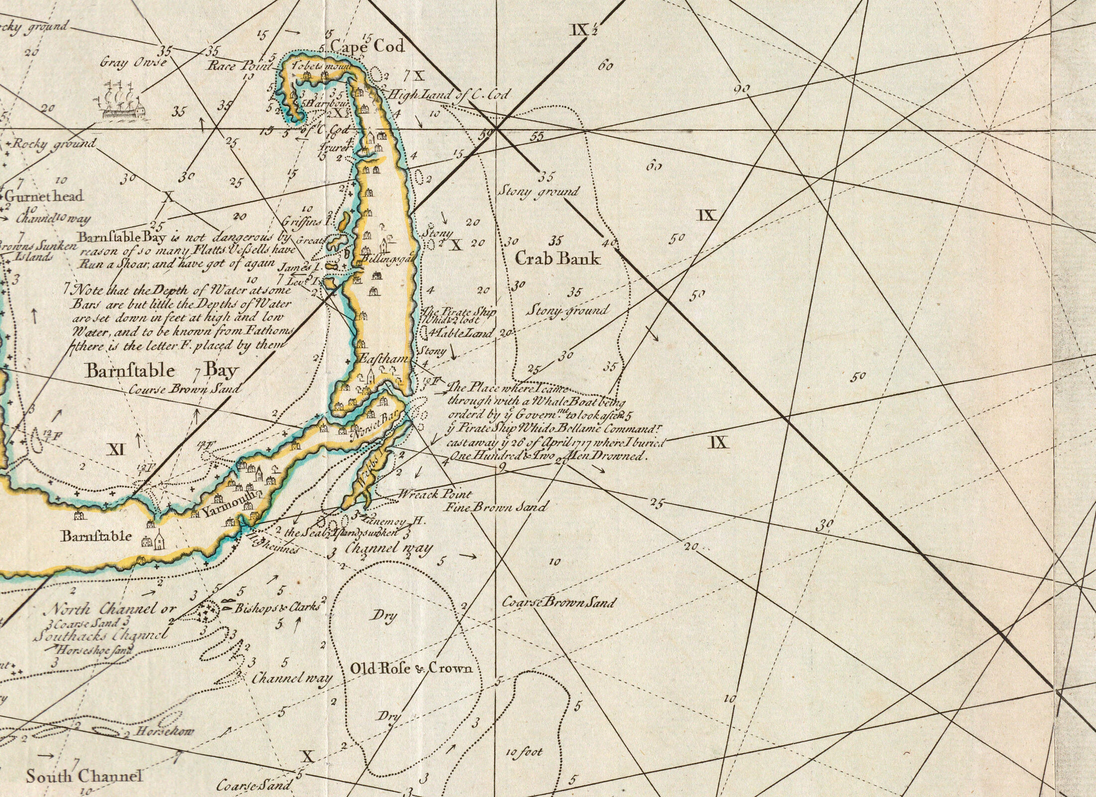
The 1734 published version of his chart (The New England Coasting Pilot) is rich with this kind of voice-of-the-cartographer commentary — depth conventions, harbor warnings, shoal hazards, even a navigable channel named after himself ("North Channel or Southack's Channel"). The map is a hybrid sailing guide, personal log, and self-portrait. Barry Clifford used this chart in 1984 to find the wreck. 267 years between the chart and the dive.
The whole Atlantic and beyond, live from MarineTraffic.com. Zoom out to see global shipping density. Zoom into chokepoints (Suez, Malacca, Red Sea, Panama) to watch traffic queue through.
The triangle trade's shape wasn't a "choice" by merchants — it was forced by physics.
- North Atlantic Gyre — giant clockwise ocean current system; the Gulf Stream is its northern limb
- Trade winds (easterlies, south of ~30°N) — carried ships Europe → Africa → Caribbean
- Westerlies (westerlies, north of ~30°N) — carried ships Caribbean → North America → Europe
The Whydah's final voyage fits this pattern: after the Caribbean, Bellamy was heading north up the American coast — riding the Gulf Stream toward the westerlies — when the nor'easter caught him off Cape Cod.
Open the wind map before you look at the trade triangle. "Why is it shaped like a triangle?" has a physical answer (the trade winds and Gulf Stream), not just an economic one.


Navigation & Projections
 Compass
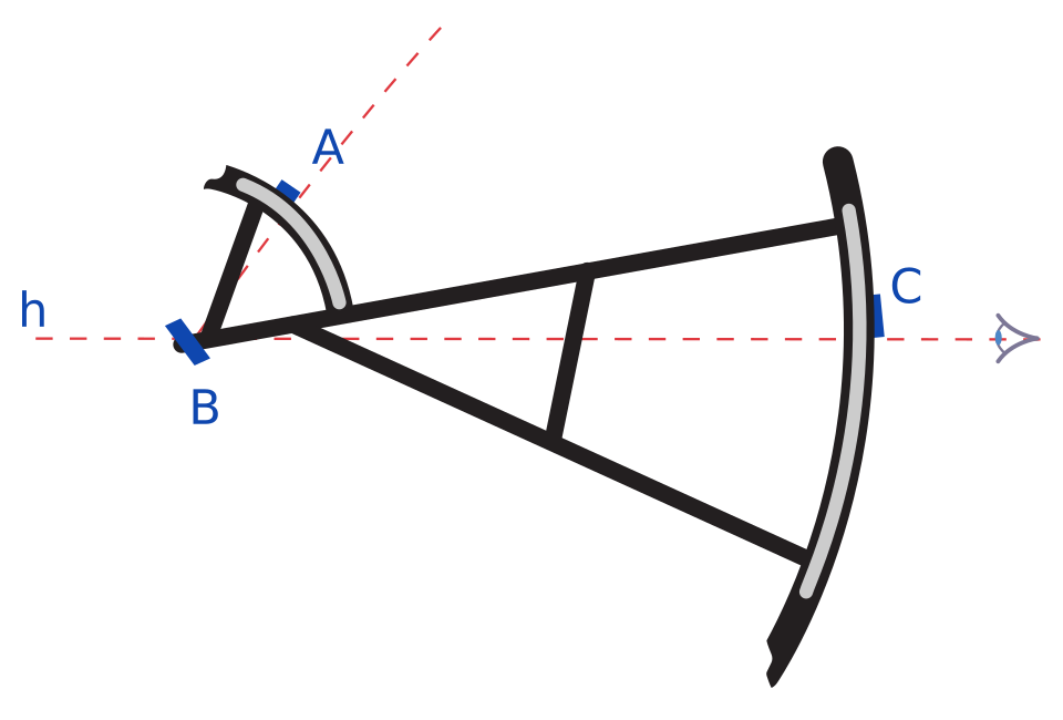 Backstaff
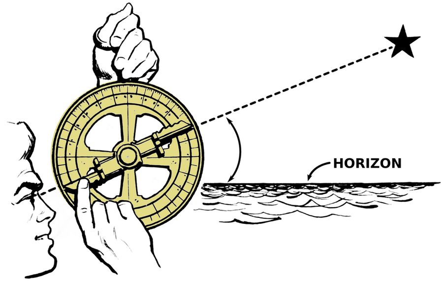 Mariner's astrolabe
What DIDN't exist yet in 1717
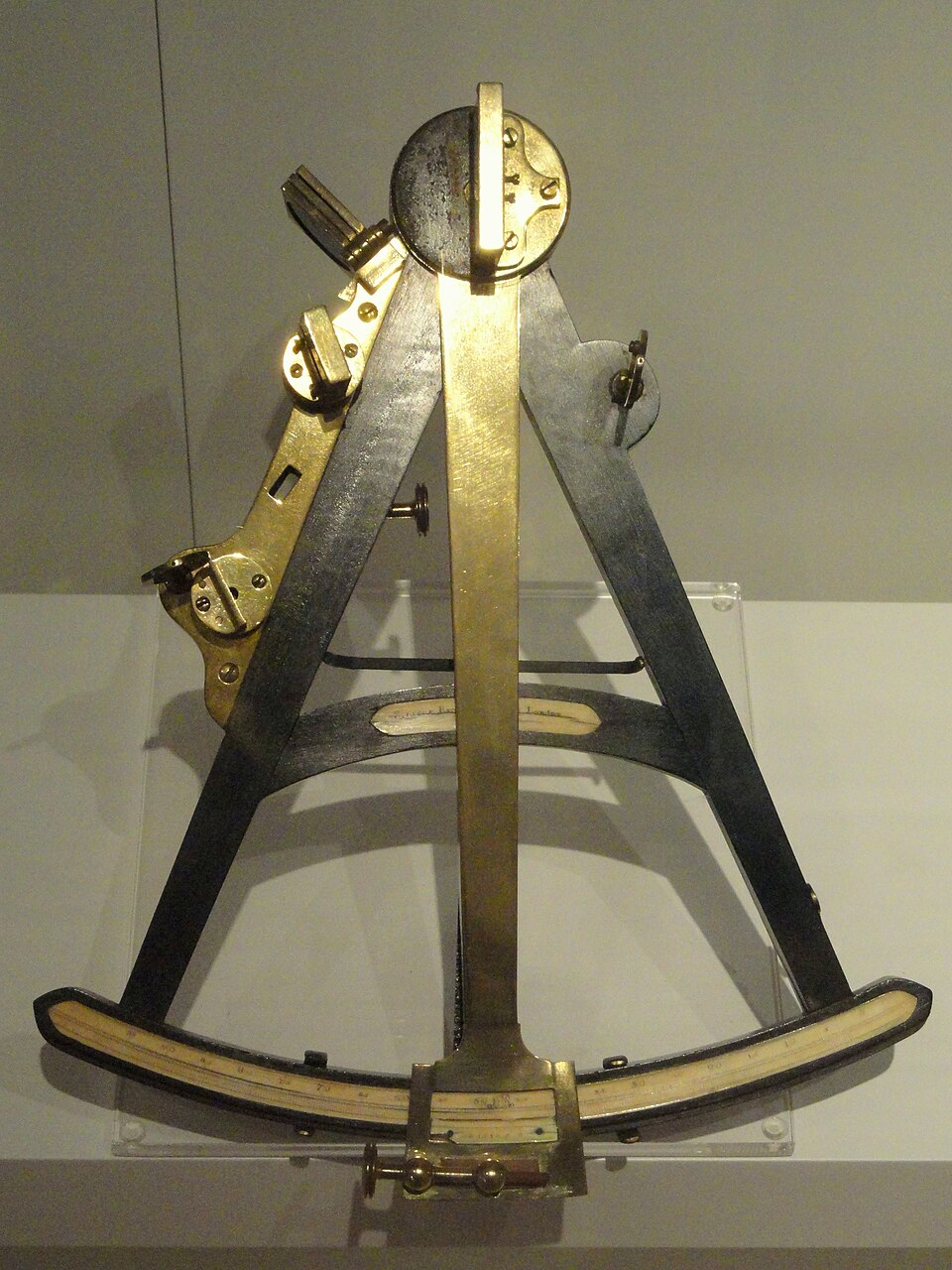 Octant
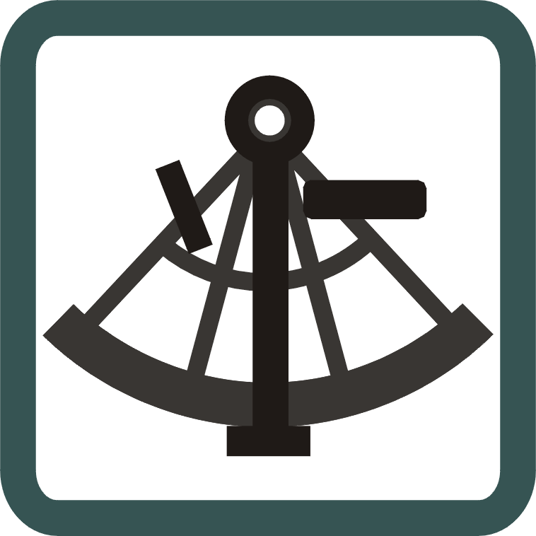 Sextant
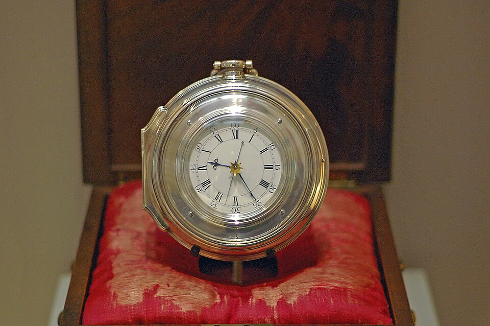 Marine chronometer (Harrison's H4)
A French mathematician named Nicolas Tissot came up with a clever test in 1859: imagine a bunch of identical circles placed evenly across the globe. Now flatten the globe onto each kind of map and watch what happens to the circles. Where they stay round, the map kept the shape right. Where they balloon up or squish flat, the map is distorting size. You can see the trade-off.


Be the navigator — hands-on. The activities below turn the ideas above into things you actually do, the way a 1717 pilot — or a modern GIS analyst — would. 🖨 Print the worksheets → (paper quadrant, declination table, dead-reckoning plotting sheet, lat/long grid).
Glossary
- Akan / Asante
- Akan-speaking peoples of modern Ghana and Côte d'Ivoire. The Asante (south-central Ghana) formed a political confederation around 1699–1701 — only sixteen years before the Whydah sank. The 79+ Akan gold ornaments recovered from the wreck (necklace beads, openwork discs, bell-shaped pendants, a cast cowrie ornament) were made by Akan goldsmiths and shipped through the Royal Africa Company's Gold Coast trade. They are the earliest reliably dated group of pre-1874 Akan gold anywhere (Ehrlich 1989). Most are clipped, folded, or hole-punched — mutilated for melting as scrap bullion at the next Atlantic port.
- Articles (Ship's Articles)
- The written rules and shares-of-loot agreement that pirate crews signed on joining a ship. Bartholomew Roberts' 1721 Articles survive (via Johnson 1724) and are the analogue we teach. The Whydah's own Articles do not survive; trial testimony confirms the crew had them. (A wounded-heart symbol appears among crew engravings found on the wreck, but it is not evidence of a signing ritual — teach the seals and engravings as artifacts, not proof.)
- Backstaff
- Sun-altitude measuring instrument invented by John Davis in 1594. The standard latitude tool of the 17th and early 18th centuries. The user faced away from the sun and read its shadow on a graduated arc - safer than looking at the sun through earlier instruments.
- Bathymetry
- The measurement of underwater depth and underwater terrain. Modern Google Earth shows seafloor bathymetry; you can use it to read the wreck site.
- Cartography
- Making and reading maps. The word comes from the Greek for "map writing." Cyprian Southack (the cartographer who marked the Whydah wreck) and Herman Moll (the most famous London mapmaker of the early 1700s) are the two who matter most for our unit.
- Chokepoint
- A narrow body of water through which a large fraction of global shipping must pass. Suez, Bab-el-Mandeb, Malacca, Panama, Gibraltar. Geographic features that give the country controlling them disproportionate leverage. Pirates concentrated near them in 1717 for the same reason modern state actors target them today.
- Commission
- An official government authorization. A privateer's commission (its letter of marque) made wartime raiding legal; when commissions were cancelled after the war ended in 1713–14, thousands of privateers were thrown out of work and many turned to piracy.
- Compass
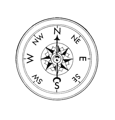
- Magnetized needle on a pivot; gives heading relative to magnetic north. Standard navigation instrument by 1717 - centuries old by then.
- Conformal projection
- A map that keeps shapes accurate (countries look the right shape) but distorts size (countries near the poles look way too big). Mercator is the famous example. Good for navigation; bad for comparing how big places really are.
- Dead reckoning
- Estimating current position from a last-known point using heading + speed + elapsed time. The only longitude method available to 1717 sailors. Error accumulated daily.
- Demobilization
- The discharge of military personnel after a war ends. The Royal Navy demobilization after the War of Spanish Succession (1713-14) put thousands of trained sailors out of work, concentrated in the Caribbean - the single biggest push factor into Golden Age piracy.
- Driving Question (DQ)
- The big question you keep returning to all unit: "Why would a person choose piracy in 1717 - and how would they want you to tell their story?"
- Equal-area projection
- A map that keeps sizes accurate (Greenland and Africa are correctly sized relative to each other) but distorts shapes (countries get squished). Mollweide, Goode, and Equal Earth are examples. Good for showing where things are spread out (people, forests, vote counts).
- Equator
- The great circle on Earth equidistant from the North and South Poles. Latitude zero. The reference line for all latitude measurements.
- Flying Gang
- The pirate community organized at Nassau by Benjamin Hornigold ~1715, after the Spanish Treasure Fleet salvage. Sam Bellamy and Edward "Blackbeard" Teach both sailed under Hornigold here.
- Galley
- A type of ship combining sails and oars. The Whydah Gally was a galley-class three-masted slaver, 110 ft, 300 tons.
- Gibbet
- An iron cage in which the body of an executed pirate was hung in public — often at a harbor entrance — as a warning to sailors. In Boston Harbor, Nix's Mate island served this purpose; the best-documented case is the pirate William Fly (1726). Distinct from the Whydah men, who were hanged at the Charlestown Ferry gallows in 1717. Students see Nix's Mate on FT3 (Georges Island / Boston Harbor Islands).
- Great circle
- The shortest path between two points on a globe. Modern airliners fly great-circle routes - it's why a flight from New York to Tokyo seems to curve up over Alaska. Sailors before accurate clocks couldn't follow these routes - too hard to keep adjusting heading.
- Gyre
- A large system of circular ocean currents. The North Atlantic Gyre - clockwise rotation between North America, Europe, Africa, and the Caribbean - physically forced the shape of the triangle trade.
- Impressment
- Forced naval service. The Royal Navy seized men off streets and merchant ships into compulsory military service. Deserting impressed naval service was a direct path into piracy.
- Latitude
- How far north or south you are from the equator. Measured in degrees - 0 at the equator, 90 at the poles. Sailors in 1717 could find this with a sextant or backstaff.
- Lee shore
- A coastline that is downwind of a sailing vessel - the wind is pushing the ship toward the shore. The most dangerous configuration for a ship in a storm. The Whydah was on a lee shore at Wellfleet on the night of April 26, 1717.
- Letter of marque
- A government license that turned a private captain into a legal privateer — permission to attack and capture enemy ships in wartime. Without one, the exact same act was piracy. The whole difference between a privateer and a pirate was this piece of paper.
- Longitude
- How far east or west you are from a chosen starting line (since 1884, that's a line through Greenwich, England). Measured in degrees. Sailors couldn't find it accurately at sea until John Harrison's H4 clock worked in 1761 - 44 years after the Whydah wrecked.
- Mercator projection
- The world map you grew up looking at. Made by Gerardus Mercator in 1569. Sailors love it because any course you can draw as a straight line on it is one you can actually sail by holding a single compass heading. Its big flaw: it makes Greenland and Antarctica look gigantic. Google Maps uses a version called Web Mercator.
- Middle Passage
- The forced sea voyage of enslaved Africans across the Atlantic to the Americas. The Whydah carried 367 captives from West Africa; 312 survived to Jamaica.
- Mutiny
- Sailors collectively refusing to obey their captain. In the Royal Navy, a capital offense. On a pirate ship, the foundational moment - most pirate crews were mutineers from naval or merchant service.
- Nor'easter
- A large storm system in the North Atlantic that travels northeastward along the U.S. East Coast, with winds blowing from the northeast. The April 26, 1717 nor'easter wrecked the Whydah at Wellfleet.
- Pink (ship type)
- A small, narrow-stern Dutch sailing ship used for cargo and fishing in the 17th-18th centuries. The Mary Anne, a pink of Dublin loaded with Madeira wine, was the prize Bellamy took on April 26, 1717 - and lost the same night.
- Primary source
- A document, artifact, or testimony created at or near the time of the events being studied. Boston Vice-Admiralty Court testimony (1717), Cotton Mather's execution sermon (1717), and Cyprian Southack's 1717 chart are primary sources for the Whydah. "Captain Charles Johnson's" General History of the Pyrates (1724) — now identified as the work of Nathaniel Mist (Bialuschewski 2004; Brooks 2015) — is partially primary as a 1724 artifact, but unreliable for specifics; the Bellamy "Beer-speech" episode is almost certainly a Mist embellishment following a St. Augustine literary trope (Frohock 2015), and Mist altered the text substantively between his May 1724 first edition and December 1724 second edition. Frohock reads the whole GH as double satire — the "Robin Hood pirate" framing you'll meet in popular sources comes from this 1724 literary work, not from contemporary record.
- Privateer
- A private armed ship licensed by a government to attack enemy shipping in wartime. Legal piracy with paperwork. When the War of Spanish Succession ended in 1713-14, thousands of privateers lost their commissions - many slid into illegal piracy.
- Prize
- A ship or cargo captured at sea. A privateer's prizes were judged and sold legally through a prize court; a pirate simply kept them.
- Prize court
- A court (often a Vice-Admiralty Court) that ruled whether a captured ship was a lawful “prize” to be sold. The paperwork that separated legal privateering from piracy. Salem's Revolutionary-era captains ran hundreds of British prizes through one at Derby Wharf.
- Projection (map projection)
- A mathematical method for representing the curved surface of the Earth on a flat map. Every projection distorts something - shape, area, distance, or direction - because flattening a sphere is mathematically impossible without trade-offs.
- Prime meridian
- The line of longitude defined as zero degrees, used as the reference for all longitude measurements. Standardized at Greenwich, England in 1884.
- Punonakanit Wampanoag
- The Indigenous people whose territory included Wellfleet, Cape Cod - the place the Whydah wrecked. Their voice is absent from the 1717 written record. Land acknowledgment is appropriate when teaching the wreck site.
- Quadrant
- Heavy metal-plate sun-altitude instrument with a plumb-bob. Older than the backstaff, still in use in 1717. More awkward to use at sea but functional.
- Quartermaster
- On a pirate ship, an elected officer second in command, responsible for distributing loot and representing the crew's interests against the captain. Paulsgrave Williams had been Bellamy's quartermaster early in their partnership; by April 1717 he was captain of the sloop Marianne, Bellamy's consort.
- Royal Africa Company (RAC)
- The English chartered company that held the legal monopoly on the African slave and gold trade from 1672 to 1698, kept slaving into the 1730s, and was dissolved in 1752. Operated forts along the West African coast — Cape Coast Castle in modern Ghana was its headquarters. The Whydah's gold-and-slave cargo passed through this trading network. After the company lost its monopoly in 1698, independent slave merchants (like Sir Humphrey Morice, who commissioned the Whydah) competed with the RAC on the same routes. The "RAC" appears throughout 18th-century Atlantic documents and is the institutional context for the Whydah's African material.
- Rhumb line
- A sailing course where you hold the same compass heading the whole way. On a Mercator map it looks like a straight line. It's not the shortest path between two points (a "great circle" is shorter) - but it's the easiest to actually steer.
- Sextant
- Precision sun- and star-altitude instrument introduced 1759. The successor to the backstaff and quadrant. Did not exist when the Whydah sailed.
- Sloop
- A small single-masted sailing vessel with a fore-and-aft rig. Common in 17th-18th-century coastal trade. Bellamy's Marianne (10 guns) and the Bonetta were sloops.
- Source criticism
- Evaluating a historical source for who created it, when, why, and how reliable it is. The whole reason we tier our own claims (Solid, Contested, Mythologized) and explicitly flag Johnson 1724 as unreliable.
- Tissot's indicatrix
- A trick for showing what a map projection messes up. Place identical circles all over the globe, then flatten the globe onto each kind of map. Where the circles stretch or squish tells you what the map gets wrong, and where. See the Navigation & Projections tab for examples.
- Trade winds
- Steady easterly winds south of about 30 degrees North that blow from Africa toward the Americas. Combined with the westerlies (north of 30 degrees N) that blow from America back toward Europe, they physically force the triangular shape of Atlantic trade.
- Triangle trade
- The 17th-18th century Atlantic trade pattern: European manufactured goods to West Africa, enslaved people from Africa to the Caribbean and Americas, raw materials (sugar, molasses, rum, cotton, tobacco) from the Americas back to Europe. The Whydah was built for this trade and named after Ouidah, a major West African slave port.
- Vice-Admiralty Court
- British colonial maritime court that tried piracy and other sea-related offenses. The Whydah survivors were tried at the Boston Vice-Admiralty Court in October 1717, before a commission headed by Governor Samuel Shute. (Judge Samuel Sewall, the apologetic 1692 witch-trial judge, is often placed on this bench in popular accounts — but the 1718 Trials of Eight Persons record does not name him among the commissioners.)
- Voyage Journal
- The student running portfolio across the unit. One deliverable per session, accumulated in a physical 3-ring binder pre-tabbed by week. The raw material the final project draws on.
- Westerlies
- Prevailing winds from the west in the mid-latitudes (roughly 30-60 degrees N and S). Carried 18th-century ships from the Americas back to Europe along the northern leg of the triangle trade.
- Whydah Gally
- The slave ship built in London 1715, captured by Sam Bellamy in February 1717 in the Caribbean, wrecked off Wellfleet, Cape Cod on April 26, 1717 (41.891°N, 69.957°W, off Marconi Beach, in roughly 16–30 ft of water). 110 ft, 300 tons, three-masted galley, 28+ guns when she wrecked. Discovered by Barry Clifford 1984; bell recovered 1985 confirmed identity. The cargo at her loss included Spanish silver, gold dust, and at least 79 documented Akan/Asante gold ornaments — the earliest reliably dated group of pre-1874 Akan goldwork anywhere (Ehrlich 1989).
Your Final Project
The choice you'll make
By the end of Week 4, you'll pick one person from this story — and choose one format to tell their story the way they would want it told.
Spend time with the People and Pirate World tabs as you go. Each character card has a short note explaining what kind of project that person opens up. There's no wrong choice. The captain, the kid, the silversmith, the slave-ship captain, the cartographer, the witch-trial judge, the modern discoverer — every one of them brings the story from a different angle.
Whatever format you pick, your final project has to cite at least 3–4 entries from your Voyage Journal as source material. The Journal is the evidence. The project is the argument.
🖨 See the one-page rubric → — what strong work looks like, and the Journal pages for every session, are all in the printable handouts packet.
Format menu — twelve ways to tell it
| Format | What it looks like |
|---|---|
| Google My Maps story map | 8–10 annotated locations along the Whydah's journey, told in your chosen voice |
| Google Slides presentation | 10–12 chapter-structured slides with images, quotes, evidence |
| Live performance | 3–5 minute monologue or two-person scene at the Showcase |
| Illustrated narrative poster | Visual timeline or map with embedded written reflection |
| Character flip book | Handmade 8-page folded flip book written in your character's voice (starter pages are in your binder) |
| Letter sequence | Correspondence in character — 4–6 letters tracking a perspective |
| Museum exhibit board | Artifacts and labels curating a single perspective's story |
| Graphic novel spread | 4–6 illustrated panels telling a scene from a perspective |
| Newspaper front page | 1717 broadside-style reporting on the Whydah or a capture |
| Google Earth narrated tour | Screen-recorded flythrough with voiceover in character |
| Ballad or sea shanty | Original song lyrics in period style, optionally performed live |
| Your own pitch | Anything else — bring the idea to Max for the green light |
The Showcase
Thursday August 6 is the public Showcase. Final projects get presented to families, faculty, and visitors. Voyage Journals lay open on tables for everyone to flip through. This is the public reveal of five weeks of work — the moment your chosen voice gets heard.
Unit Plan
DQ: Why would a person choose piracy in 1717 — and how would they want you to tell their story?
KSQs: 1. Maps & power · 2. Atlantic trade · 3. Geography & choice · 4. Whose stories
Format: 13 instructional sessions + 3 confirmed field trips + 1 in-class Synthesis Studio + 2 build days + public Showcase · 2 sections × ~20 students · 90 min/section · No grades · Voyage Journal binders + Final project (12 formats)
Field trips (confirmed 2026-07-02 — no 2nd museum trip): FT1 Real Pirates Salem + Salem Maritime NHS rotation (Wed Jul 15) · FT2 Kayaking (Thu Jul 16) · FT3 Georges Island / Boston Harbor Islands (Thu Jul 23). Mon Aug 3 = S17 Synthesis Studio, in class.
Nav & GIS skills (KSQ1): read a map as an argument · use 1717 tools (compass, backstaff, dead reckoning) · find latitude and explain why longitude was unsolved · read & write coordinates · georeference an old map and use a grid (the 1717→1984 wreck story = GIS) · projections and their trade-offs.
Build & Pacing Tracker
Before the unit (prep)
- Build the timed 90-min flow for each of the 13 instructional sessions (Do-Now · mini-lesson · activity · Journal · share)
- Finalize the Voyage Journal handouts (one per session deliverable, plus trip-day sheets)
- Assemble the pre-screened readings packet (Equiano excerpt, Bellamy capture accounts, Roberts' Articles, optional Mather line for the S11 survivor coda)
- Write the final-project rubric — one page, works across all 12 formats
- Make the VJ binder template + weekly tab dividers + DQ cover page (binders distributed Day 2 — Day 1 is a no-materials intro)
- Confirm the Chromebook cart for S4, S5, S11, S13, S14 (students pair up; back up with handouts)
- Print the S1 artifact hook images + the DQ wall poster
- FT1 (Wed Jul 15): permission slips, transport, chaperones, Real Pirates scavenger hunt + Salem Maritime worksheet; curator-led with Frank Cutietta if available
- FT2 (Thu Jul 16, kayaking): outfitter/vendor, life-vests + water safety, transport, lunch; ~10-min pre-paddle brief off the Why Piracy tab
- FT3 (Thu Jul 23, Georges Island): ferry booking, transport to the ferry, lunch, weather contingency; print the Georges Island pre-trip briefing
- Showcase (Aug 6): family invites, room layout, A/V for performance / Google-Earth-tour formats, closing-circle script
- Push the
Pirate_Unitsource folder to the repo (whitelist asource-material/dir) so research + hi-res art are in hand
Weekly pace check — tick when that week's Journal entries are in students' binders
- Week 1 (Jul 6–9): route map · map annotation · 1719 analysis card · "Routes of My Life" map
- Week 2 (Jul 13–16): triangle-trade map · Middle Passage reflection · FT1 museum notes · FT2 kayak Captain's Log + weekly writing
- Week 3 (Jul 20–23): push/pull T-chart + Crew Card · Articles rewrite + wax-seal signing · storm drawing + wreck map + land acknowledgment · FT3 harbor sketch-map + Captain's Log
- Week 4 (Jul 27–30): grid-archaeology (Southack→Clifford) · chokepoint comparison · then-and-now trace-one-item · perspective + format pitch
- Week 5 (Aug 3–6): Synthesis Studio entry · build day 1 · build day 2 + peer review · Showcase
Five-Week Calendar
Jul 6–9
Jul 13–16
Jul 20–23
Jul 27–30
Aug 3–6
Session Cards (click to expand)
Launching the Voyage
Voyage Journal: Quick-write + hand-drawn route from home
Reflection: What questions do you already have about the world of the Whydah?
Activities: Hook with a powerful artifact image (King's shoe, the bell, or 1719 map). Post the DQ on the wall as a permanent reference. Quick-write: "If you had to leave everything behind and start over at sea, what would your world have to look like?" Pair-share, whole-class circle. Brief Whydah intro — spark only, no spoilers.
90-min flow: Do-Now (10): silent look at the projected hook artifact (the bell, John King's shoe, or the 1719 map) — jot 3 things you notice, 2 questions. · Reveal (10): post the Driving Question on the wall to live there all unit; 90-second Whydah spark, no spoilers. · Quick-write + pair-share (25): “If you had to leave everything behind and start over at sea, what would your world have to look like?” · Route map (25): hand-draw the routes you travel on an ordinary day. · Journal + circle (20): keep both to file in the binder (binders begin Day 2 — Day 1 is a no-materials intro); whole-class circle — one question you now carry.
Vocab: Driving Question · perspective · voyage · primary source
Discussion: What makes you trust — or doubt — a story about the past? · Whose version of the Whydah’s story do you think we’ll get the most of, and whose the least? · What’s the difference between a movie pirate and a real person who chose piracy?
Watch for: kids arrive with Hollywood pirates (eye patches, treasure maps, walking the plank) — most of that is myth; promise that all unit we separate evidence from legend. “Pirate” is not a cartoon villain.
Exit check: a half-page quick-write + a labeled day-map, and every student can say the Driving Question in their own words.
What Is a Map?
Voyage Journal: Annotated comparison: modern Salem vs. 1700s New England
Reflection: What would a map of your life include that a stranger's map of you would leave out?
Activities: Define cartography, projection, scale, symbols. Side-by-side comparison: modern Google Maps Salem vs. a 1700s New England map. Introduce Mercator projection — rhumb lines as straight lines, why Google Maps still uses Web Mercator. Small-group annotation: what's shown, what's missing, whose perspective?
90-min flow: Do-Now (10): two Salems side by side (Google Maps vs a 1700s map) — what's the same, what's gone? · Mini-lesson (20): cartography, projection, scale, legend; Mercator + rhumb lines, and why Google still uses Web Mercator. · Group annotation (40): mark up both maps — what's shown, what's left out, whose point of view. · Journal (10): finish the annotated comparison. · Close (10): exit ticket — “what would a map of your life leave out?”
Vocab: cartography · projection · legend · rhumb line
Discussion: If two maps of Salem disagree, is one of them “wrong”? · What does a map choose to show — and who makes that choice? · Why might a 1700s mapmaker leave something off on purpose?
Watch for: kids think maps are neutral pictures of reality. Every map is a set of choices (what’s centered, labeled, left off). “North is up” is a convention, not a law.
Exit check: the annotation names at least 2 things each map shows or hides, and identifies whose point of view it takes.
Reading the 1719 World Map
Voyage Journal: Analysis card on the 1719 Moll world map
Reflection: If the 1719 map is an argument, what argument is it making — and who is making it?
Activities: Close-read Herman Moll's 1719 world map (or the Real Pirates Salem Educator Guide version). Introduce Moll — London's premier cartographer with a social circle that included pirates and privateers (Dampier, Rogers, Hacke). His maps were partly built from pirate intelligence. Anchor: maps are arguments, not neutral records.
90-min flow: Do-Now (10): project Moll's 1719 world map — find one thing that looks wrong to modern eyes. · Mini-lesson (20): who Moll was — London's top mapmaker, drinking with pirates and privateers, selling their route data. · Close-read (40): analysis-card the map — who made it, whose view, what it argues. · Journal (10): finish the analysis card. · Close (10): “if this map is an argument, what's the argument — and who's making it?”
Vocab: cartographer · empire · intelligence · argument
Discussion: Who paid for maps like this, and what did they want from them? · How can a map be an “argument”? · If Moll used pirates’ information, who really “made” this map?
Watch for: kids assume old maps are just less-accurate Google Maps. They’re arguments about power and ownership. A blank or decorated area usually means “unknown to Europeans,” not “empty.”
Exit check: the analysis card names the mapmaker, the perspective, and one specific claim the map makes.
Weekly extended writing prompt: Describe a place you know well. List three things a map of that place would leave out. Why?
My Maps + Navigation Tools + Adopt a Ship
Voyage Journal: "Routes of My Life" Google My Map + adopted ship's first log
Reflection: What does your "Routes of My Life" map say about you — and what does it hide?
Activities: Tutorial on Google My Maps. Period navigation tools: compass, backstaff, quadrant, dead reckoning. The longitude problem in 1717 — latitude findable, longitude not. 1707 Scilly Isles disaster → 1714 Longitude Act → Harrison's chronometer 1761 (44 years too late). MarineTraffic introduction — each student picks a ship to track across the unit. Build "Routes of My Life" map.
90-min flow: Do-Now (10): pass around the period tools (compass, backstaff) or images — guess what each one did. · Mini-lesson (20): the longitude problem — latitude findable, longitude not; Scilly 1707 → Longitude Act 1714 → Harrison 1761 (44 years too late). · Build (40): Google My Maps tutorial → start “Routes of My Life”; pick a MarineTraffic ship to adopt for the whole unit. · Journal (10): first log entry for your adopted ship. · Close (10): “what does your map say about you — and what does it hide?”
Vocab: layer · annotation · compass · backstaff · latitude · longitude
Discussion: Why was latitude findable in 1717 but longitude almost impossible? · What does your “Routes of My Life” map reveal about you — and what does it hide? · How is tracking a ship on MarineTraffic like, and unlike, what a 1717 navigator could do?
Watch for: kids assume sailors always knew where they were — east-west, they often didn’t. GPS feels eternal but is ~50 years old. A compass gives direction, not position.
Exit check: a working My Map with 3–5 annotated routes + a first ship-log entry, and they can explain the longitude problem in a sentence.
The Atlantic World in 1715 — and Today
Voyage Journal: Triangle-trade map + MarineTraffic Atlantic screenshot alongside
Reflection: Who benefits when a ship like the Whydah crosses the ocean — then? Now?
Activities: Establish 1715 Atlantic world. Trade winds + gyre — physical geography forced the triangle's shape. Plot Whydah's pre-piracy route: London → Ouidah → Jamaica. The ship's name = Ouidah, Benin (2nd largest Atlantic slave port). Sir Humphrey Morice, sitting MP and London's foremost slave merchant, commissioned her. What she carried back from Africa wasn't just "gold dust" — it was hundreds of Akan ornaments (necklaces, bracelets, regalia made by named West African peoples — the Asante and Baule of modern Ghana and Côte d'Ivoire), clipped, folded, and hole-punched to convert royal art into weighed scrap gold for melting. Show the Ehrlich 1989 photographs (S5/S6/S17). The same voyage that commodified 367 humans also commodified African art. Modern bridge: open MarineTraffic Atlantic alongside the class triangle map. Same routes, 300 years.
90-min flow: Do-Now (10): open MarineTraffic's Atlantic — where are ships clustered, and why might that be? · Mini-lesson (20): trade winds + the gyre force the triangle's shape; plot London → Ouidah → Jamaica; the ship's name is a slave port. · Map work (40): build the triangle-trade map; screenshot today's MarineTraffic Atlantic beside it. · Journal (10): finish the paired map. · Close (10): “who benefits when the Whydah crosses — then? now?”
Vocab: triangle trade · gyre · trade winds · empire
Discussion: Why did the trade form a triangle instead of a straight line? · Who profited from each leg, and who paid? · On MarineTraffic today, what’s changed about who carries what — and what hasn’t?
Watch for: kids picture a tidy, equal three-way swap. The “middle” leg moved human beings and was the deadliest. Trade winds aren’t a metaphor — the physical wind pattern forced the route.
Exit check: a triangle map with every leg labeled by its cargo (including people) + one 1717-vs-today sentence.
The Middle Passage
Voyage Journal: Middle Passage silent-writing reflection
Reflection: What does it mean to map a voyage when not everyone on the ship chose to be there?
Activities: Read pre-screened, age-appropriate Equiano excerpt (note: 1756 capture, not Whydah-era — Middle Passage voice not Whydah voice). Cargo data: 367 captives → 312 survived. Silent writing time. Add the Middle Passage leg to the class Whydah route map.
90-min flow: Do-Now (10): the numbers on the board — 367 loaded, 312 survived; sit with them quietly. · Set-up (15): frame the pre-screened Equiano excerpt (a Middle Passage voice from 1756, not Whydah-era). · Read + silent writing (40): read together, then private reflection — no pressure to discuss. · Map (15): add the Middle Passage leg to the class route map. · Close (10): voluntary share only; exit on the reflection question.
Vocab: Middle Passage · testimony · dehumanization · survivor
Discussion: What can numbers tell us about the Middle Passage — and what can’t they? · Why does it matter to map a voyage when most people aboard didn’t choose to be there? · How do we tell a story when the people in it left no written record?
Watch for: kids may treat enslaved people as cargo or statistics — the point is to re-humanize. Equiano is a Middle Passage voice but NOT Whydah-era; don’t conflate them.
Exit check: full use of the silent-writing time and honest engagement — there is no ‘right answer’ — plus the Middle Passage leg added to the map.
Real Pirates Salem + Salem Maritime NHS (rotation)
Voyage Journal: Combined log + perspective notes + Friendship sketch
Reflection: What did you see today that a book couldn't have shown you?
Structure: Two sections start at opposite sites. Section A morning at Real Pirates Salem (Whydah scavenger hunt) / Section B morning at Salem Maritime NHS (the Friendship + Derby Wharf + Custom House). Lunch. Sections swap for the afternoon. Each student experiences both.
At Real Pirates: structured scavenger hunt, one artifact per KSQ, perspective scouting.
At Salem Maritime: walk through the Friendship (replica 1797 East Indiaman), Derby Wharf, Custom House.
Vocab: artifact · curator · provenance · East Indiaman · wharf
Kayaking — the life-at-sea day
Voyage Journal: Captain's Log voice entry on/after the water + weekly extended writing
Reflection: After a day on the water, what would make someone risk a pirate crew for this life?
Structure: On-the-water day with an outfitter (life-vests, water safety, LEAP transport + lunch). Pre-paddle brief (~10 min, off the Why Piracy tab): the four 1717 ship types (slave · navy · merchant · fishing) — rank them by quality of life; Royal Navy wages frozen 1653–1797; slave-ship crew mortality 21.6% (about 1 in 5). Why life at sea was brutal, and why people risked piracy.
On the water: read the water, feel the work, tie back to dead reckoning and Week 1 navigation. Captain's Log voice entry on or after the water.
Vocab: current · dead reckoning · crew
Discussion: If every ship was hard, why would anyone pick the pirate one? · What did your arms tell you about a sailor’s day that a book couldn’t?
Watch for: kids romanticize sailing life. Frozen wages, floggings, disease, and impressment were normal — the paddle is the point: this was work.
Weekly extended writing prompt: Imagine you're a 1717 sailor choosing between a merchant ship, the Royal Navy, or a pirate crew — after today on the water, what would you pick, and why?
The Vote — Who Chose Piracy?
Voyage Journal: Push/pull T-chart for one chosen crew member
Reflection: Which crew member's story surprised you the most — and why?
Activities: Flying Gang at Nassau. Hornigold mentored both Bellamy and Blackbeard. Summer 1716: Bellamy's crew voted Hornigold out — pirate democracy in action. Profile sketches with diversity emphasis: Bellamy (Devon, Navy vet, ship's boy at 13), Williams (wealthy RI silversmith — class contrast), Julian (Miskito, pilot at 16), King (boy pirate, age 11), the hanged six (Brown-Jamaica, Baker & Quintor-Netherlands [Quintor was Black, Dutch-African per Clifford & Kinkor 2007], Hoof-Sweden, Shaun-France, van der Vorst-NY). ~25% Black per Kinkor. Analytical question: Why was a flatter racial hierarchy possible on a pirate ship in 1717 when surrounding world was deeply racist?
90-min flow: Do-Now (10): Hornigold voted out for refusing to attack English ships — what does that tell you about pirate crews? · Mini-lesson (20): crew profiles — Bellamy, Williams, Julian, King, the hanged six; ~25% Black; the flatter-hierarchy question. · T-chart (40): pick one crew member; build a push/pull T-chart from the evidence. · Journal (10): finish the T-chart. · Close (10): “which crew member's story surprised you most?”
Vocab: push factor · pull factor · recruit · desert · mentor
Discussion: What pushed sailors away from other work, and what pulled them toward piracy? · Why could a pirate crew be more equal than the world around it? · Does a hard situation explain a choice — or excuse it?
Watch for: kids want pirates to be heroes OR villains. Hold both: escaping real brutality AND robbing people. The on-ship “democracy” was real but limited — still violent, still theft.
Exit check: a push/pull T-chart for one crew member with at least 3 of each, grounded in evidence.
The Ship's Articles
Voyage Journal: Personal rewrite of the Ship's Articles for a modern classroom
Reflection: Would you sign on to a set of articles like these? What would worry you?
Activities: Whydah's text doesn't survive, but trial testimony confirms the crew had articles + voting/signing requirement (Rediker 2004). (A wounded-heart symbol appears among wreck engravings, but it is not evidence of the signing — teach the artifacts as artifacts.) We use Roberts' 1721 articles (via Johnson 1724) as analogue. Read Roberts' age-adapted; compare to Royal Navy rules. Equal-shares principle was practice, not just text — Black and white sailors got the same share. Small-group rewrite for modern classroom, then the class wax-seal signing ceremony: whole class votes on the rules and each student signs the master copy with a real red wax seal (the seal goes in the binder). Math extension (optional): the New England Pirate Museum's Divide the Prize activity (eddivide.htm) is a usable shares-and-proportions word problem — though commodity prices need updating and the Frohock 2015 caveat applies (the GH satirizes its own articles). Critical-reading caveat: the "equal-shares-regardless-of-race" claim is supported by some testimony but Bialuschewski 2008 disputes it; Frohock 2015 reads the GH's articles as deliberately ironic. Hold the moral complexity.
90-min flow: Do-Now (10): would you sign on to rules you helped write? would you sign rules you didn't? · Mini-lesson (20): the Whydah's Articles are lost, but trial testimony proves they existed; read Roberts' 1721 articles (age-adapted) vs Navy rules — hold the equal-shares debate. · Rewrite (40): small groups rewrite the Articles for a modern classroom (optional Divide-the-Prize math extension). · Journal (10): record your group's articles. · Close (10): “would you sign on? what would worry you?”
Vocab: articles · covenant · democratic · mutiny · analogue · shares-and-proportions
Discussion: Would rules feel different if you helped write and vote on them? · Why might equal shares matter more than the exact words of the articles? · Where’s the line between a democracy and a gang?
Watch for: kids assume we have the Whydah’s actual articles — we don’t. We use Roberts’ 1721 as an analogue, and even those come through a 1724 book that may satirize them. There was no single official “pirate code.”
Exit check: 5–7 class articles written, plus an answer to “would you sign?”
The Wreck
Voyage Journal: Storm drawing (before evidence) + wreck site map + written land acknowledgment. Exact coordinates: 41.891°N, 69.957°W (off Marconi Beach, Wellfleet).
Reflection: If the Whydah had not wrecked, would we know any of these people's names?
Activities: "Tonight, April 26, 1717, at 12:15 AM, the Whydah hits a sand bar. There's a storm. There are 146 people on board. Two are still alive in the morning." DRAW THE STORM before any evidence is shown (15 min) — then compare imagination to the record. The actual story: nor'easter catches Bellamy's fleet of four (Whydah, Mary Anne captured that same day, Marianne with Williams away at Block Island, Anne Galley). Whydah grounds at Marconi Beach, Wellfleet; 146 souls, 102 bodies recovered, only 2 Whydah survivors (Julian, Davis). Mary Anne wrecks south; all 10 aboard survive. Cape Cod responders named: John Cole and William Smith paddle out by canoe to rescue the Mary Anne survivors; Joseph Doane of Eastham (justice of the peace) makes the arrests and takes prisoners to Barnstable gaol; Samuel Harding of Wellfleet shelters Davis — then takes most of the salvage before the Crown arrives (Southack: "as Gilty as the Pirates saved"). Land acknowledgment: Punonakanit Wampanoag territory; their voice absent from the 1717 record. Map the wreck on Google Earth (bathymetry on). Closing coda (~8 min, teacher-told): what happened to the survivors. Nine of Bellamy's men survived the night (2 Whydah + 7 Mary Anne). Taken to Boston; tried before an Admiralty court, with Cotton Mather — the Salem-known minister — ministering to them and walking them to the gallows; 6 hanged (Nov 15, 1717) at the Charlestown Ferry gallows, 2 freed, John Julian (16) sold into slavery. Plain English — and it sets up tomorrow's harbor trip.
90-min flow: Do-Now + draw the storm (15): set the scene — 12:15 AM, a nor'easter on a lee shore in the dark — and draw it before any evidence. · Mini-lesson (20): the four-ship fleet and the night; 146 aboard, 2 survive; the Cape Cod responders (Cole, Smith, Doane, Harding); the land acknowledgment (Punonakanit Wampanoag, absent from the 1717 record). · Map (30): map the wreck site on Google Earth (41.891°N, 69.957°W); introduce bathymetry. · Coda (8): teacher-told — what happened to the survivors (Boston, the trial, Mather's walk, 6 hanged / 2 freed / Julian sold). · Journal + close (17): finish the storm drawing + wreck map + land acknowledgment; “without the wreck, would we know any of these names?”
Vocab: wreck · survivor · land acknowledgment
Discussion: Was the wreck bad luck, bad navigation, or both? · If the Whydah hadn’t wrecked, would we know any of these names? · Whose story of this shore is missing from the 1717 record?
Watch for: kids think the crew were just bad sailors. They cut their own cables trying to beach her; the missing tool (longitude) mattered more than skill. A lee shore in a storm is a death trap for anyone. In the coda, keep the real-vs-made-up discipline: “let’s figure out which one is real” — no jargon needed.
Exit check: a storm drawing + the wreck mapped at the correct coordinates + a thoughtful written land acknowledgment.
Weekly extended writing prompt: Pick one person who died in the wreck or stood trial. Write a paragraph about who you imagine they were.
Georges Island / Boston Harbor Islands
Voyage Journal: Sketch-map of the harbor approach + Captain's Log entry in a chosen voice
Reflection: Standing at the harbor gateway, how does where a story ends change the way you'd tell it?
Structure: The pirate story's physical ending. Yesterday the class learned how the story ended in a Boston courtroom; today they ride out into Boston Harbor — the gateway to the city where the Whydah's captured crew were tried and hanged. Experiential + light history (see the Georges Island pre-trip briefing and the Boston Harbor block on the Salem Connection tab): the harbor as the gateway every ship had to pass; Nix's Mate, the little island where convicted pirates were gibbeted as a warning to sailors (best-documented: William Fly, 1726 — keep him distinct from the Whydah men); Fort Warren as a later layer of harbor defense (begun 1833 — Civil War, not pirate-era). The Nix's Mate "shrinking curse" is folklore — flag it 🔴.
On-site Voyage Journal: sketch-map the harbor approach; a Captain's Log entry in a chosen voice (a captured crew member awaiting judgment · a Boston official · a free sailor reading the warning). Then-and-now: what did this harbor guard against in 1717, and what passes through Boston Harbor today? Bridges Week 3 → Week 4 (same harbor, container ships today).
Vocab: harbor · gibbet · gateway
Watch for: don’t merge the two true stories — the Whydah men were hanged at the Charlestown Ferry in 1717; the caged pirate on Nix’s Mate is William Fly in 1726. And we don’t claim the crew were brought in by sea through this harbor — that route is unverified; the harbor is the gateway to the city where the story ended.
Lost and Found (1717 → 1984)
Voyage Journal: Grid-archaeology dig-square exercise
Reflection: Why does evidence matter for the story you tell?
Activities: 1717: Gov. Samuel Shute dispatches Cyprian Southack (1662–1745), cartographer + naval militia commander, to salvage. Southack sails from Boston on the sloop Nathaniel, arrives at Cape Cod Harbor (Provincetown) May 2, sends two men ahead that afternoon, crosses the Cape by whaleboat through Jeremiah's Gutter (a tidal passage since lost) and reaches the wreck site May 3. He posts notices on meetinghouse doors demanding return of salvaged goods; the locals — Harding among them ("as Gilty as the Pirates saved," Southack wrote) — give up almost nothing. He recovers little but marks the wreck on his New England chart. 1984: Barry Clifford finds the wreck using Southack's 267-year-old map. Grid-based excavation method = direct ancestor of GIS. Active investigation: Southack 1717 + Clifford 1984 grid side by side — kids mark on a Southack copy where they think Clifford should dig; reveal where he actually did.
90-min flow: Do-Now (10): one map, 267 years — Southack draws it in 1717, Clifford finds the wreck with it in 1984. · Mini-lesson (15): Southack's salvage trip (Provincetown May 2 → the wreck May 3 via Jeremiah's Gutter; notices posted; almost nothing recovered); grid excavation as the direct ancestor of GIS. · Dig grid (45): the grid-archaeology exercise — mark where you'd dig on a Southack copy, then map a simulated dig square by coordinates on Google Earth. · Journal (10): finish the dig-square sheet. · Close (10): “why does evidence matter for the story you tell?”
Vocab: salvage · grid · archaeology
Discussion: How did a 267-year-old hand-drawn map find a real wreck? · Why does knowing WHERE each object was found matter? · How is an archaeology grid like the layers on your phone’s map app?
Watch for: kids think “finding treasure” is the goal. Provenance — where and how something was found — is what makes it evidence, not loot. Clifford didn’t get lucky; he georeferenced an old map. (And the famous red X on Southack reproductions is a later addition — his own mark was the label “Pirate Ship Whido lost.”)
Exit check: a labeled dig grid with finds logged by coordinate + an explanation of why location matters.
Where Ships Squeeze Through — Then and Now
Voyage Journal: Pirate voyage plan + chokepoint comparison screenshots
Reflection: What does where someone chooses to sail tell you about what they're running from — or toward?
Activities: The big modern bridge. Where pirates operated — chokepoints, sea lanes, weak colonial control. Plot Bellamy's Caribbean captures (50+ vessels over roughly a year; he hunted the Windward Passage). Hands-on with period nav tools. Plan a Jamaica-to-Carolinas voyage with 1717 tools. Then MarineTraffic chokepoints today: Suez (~12% of world trade), Malacca (one-third of global shipping), Red Sea / Bab-el-Mandeb (Houthi attacks 2023–present), Panama (the 2023–24 drought story — see the hook note below). Same geography logic, 300 years apart. Frame: use Anderson 1995's three-type taxonomy (parasitic / intrinsic / episodic) and Scheffler 2010's three-factor hotspot model — (1) waterway proximity + (2) unpoliced waters + (3) coastal economic deprivation — to show that 1717 Caribbean piracy and modern Somali piracy are the same machine, not a coincidence of vibes.
Panama hook (updated July 2026): In 2023–24, drought forced the Panama Canal to cut daily ship transits by about a third — and although rains refilled it by 2025, forecasters warned in 2026 that a new El Niño could dry it out again (the ACP announced precautionary draft reductions in mid-2026). Don't teach it as "currently half-empty" — the drought story is past-tense; the forward-looking risk is the hook.
90-min flow: Do-Now (10): MarineTraffic on Suez or Malacca — why do ships bunch up right there? · Mini-lesson (20): where pirates operated — chokepoints, sea lanes, weak control; Anderson's three types + Scheffler's 3-factor hotspot model. · Plan + compare (40): plan a Jamaica → Carolinas voyage with 1717 tools; screenshot modern chokepoints (Suez, Malacca, Red Sea, Panama) beside it. · Journal (10): finish the voyage plan + comparison. · Close (10): name the three factors that make 1717 and today “the same machine.”
Vocab: chokepoint · shipping lane · pirate (modern)
Discussion: Why do pirates — then and now — cluster at the same kinds of places? · What three things turn a stretch of water into a piracy hotspot? · If you fixed one of those three, would piracy stop or just move?
Watch for: kids think piracy is over, or only “Somalia.” It’s current — Somali piracy resurged 2024–2026 (MV Ruen retaken March 16, 2024), the Gulf of Guinea and Red Sea stay active — and it follows the same geography. Chokepoints aren’t random — coastlines and trade force them.
Exit check: a plotted voyage + a chokepoint comparison that names the 3 hotspot factors with a modern example.
Weekly extended writing prompt: What is one reason to leave and one reason to join that you think mattered most for the Whydah's crew? Support with evidence.
Salem Then and Now
Voyage Journal: Trace-one-item route map (something from your backpack, plotted on Google My Maps)
Reflection: What's still happening today that started in 1717?
Activities: Derby Wharf in the 1700s next to a modern container ship at the Port of Boston — same wharves still standing. Salem's wharves were part of the same Atlantic system the Whydah served (Donnan 1930: Salem "the most active of the Massachusetts ports" in the post-Revolutionary slave trade — named ships, named merchants). Today the global trade system moves through ports; the ships are bigger, the workers mostly invisible. Same questions about who benefits and who suffers. Trace one item: each kid picks something in their backpack (phone, pencil, shirt), figures out where it was made, plots the route on Google My Maps, looks up what kind of ship probably carried it. Primary-source close-read woven in: one sentence from the surviving record, read aloud with a single guiding question. Philip Ashton (Marblehead fisherman, pirate captive 1722–25, rescued by a Salem brigantine) is the local hook — see the Salem Connection tab.
90-min flow: Do-Now (10): two images — Derby Wharf 1700s, Port of Boston today. What's the same? · Mini-lesson (20): Salem's maritime economy in the Atlantic system (Donnan's named ships and merchants); Ashton as the North Shore pirate story. · Trace one item (40): pick an object, find its origin, plot its probable route, identify the ship type that carried it. · Journal (10): finish the route map. · Close (10): “what's still happening today that started in 1717?”
Vocab: wharf · container · global trade
Discussion: Who benefits and who suffers in today’s trade system — and how would we know? · Whose labor moves the things you own? · What does Salem’s own record (Donnan’s named ships) do to the “slavery happened elsewhere” story?
Watch for: kids treat the trade system as history. The wharves still stand and the system still runs — the point of trace-one-item is that their own backpack is in it. Keep the Salem-complicity thread factual: named ships, named merchants, no hand-wringing.
Exit check: a traced item with origin, route, and probable ship type + one then-vs-now sentence.
Weekly extended writing prompt: Pick one artifact you'd want to hold. What would it tell you the written record can't?
My Final Project — Choosing Your Perspective
Voyage Journal: Perspective + format pitch + final project source plan (3–4 Journal entries)
Reflection: Why did you choose the perspective you chose?
Activities: The perspective + format menus have been on the wall since Day 1 and the Tracker page has been narrowing weekly — today is confirmation, not a cold pick. Full perspective menu (15+ options: Black, Indigenous, multinational crew, Salem-figure including Philip Ashton, modern; Lambert for the built-from-silence challenge). Each student writes one-paragraph justification. Final project format menu (12 options + student pitch) with format-specific scaffolds. Students pick format. Partner share — one-minute plan articulation, one sharpening question. Quick check on adopted ships from S4.
90-min flow: Do-Now (10): scan the perspective menu — which voice pulls at you? · Mini-lesson (15): the 15+ perspectives and the 12 project formats, with their format-specific scaffolds. · Pitch + plan (45): write your one-paragraph perspective justification; pick a format; list the 3–4 Journal entries you'll build from; partner share (1-min pitch + one sharpening question). · Journal (10): finish the pitch + source plan. · Close (10): quick check on your adopted ship from S4.
Vocab: perspective · voice · stance · audience
Discussion: Whose perspective do you understand well enough to tell honestly? · What does your chosen format do well that another wouldn’t? · Which Journal entries are your strongest evidence?
Watch for: kids pick a format before a perspective — perspective should drive the project. “Telling someone’s story” isn’t inventing their thoughts; it’s grounding a voice in evidence.
Exit check: a one-paragraph perspective justification + a format + 3–4 named Journal sources.
Synthesis Studio (in-class)
Voyage Journal: Synthesis-lens entry — 4 artifacts/moments chosen through your perspective + KSQ4 paragraph + adopted-ship final note
Reflection: Looking back as your chosen person — what did you notice this time that you missed the first time?
Activities: (Replaces the earlier planned 2nd museum trip — there is no 2nd museum visit.) Students revisit the unit AS the perspective they chose on S16 — in class, using the dashboard's Artifacts → Sessions tab and their own Voyage Journals instead of the museum. Task: choose 4 artifacts/moments that matter to your perspective and explain why. Whole-group synthesis circle (~20 min) on KSQ4: across five weeks, whose stories did we hear, whose stayed buried? Final adopted-ship check-in (Modern Oceans thread closes). Teacher conferences (5 min/student) as time allows.
90-min flow: Do-Now (10): re-enter the unit as your person — what would they notice first? · Revisit (40): work through the Artifacts tab + your own Journal as your perspective; choose 4 artifacts/moments and explain why they matter to your person. · Synthesis circle (20): KSQ4 — whose stories did we hear, whose stayed buried? · Journal + close (20): synthesis-lens entry + final adopted-ship note.
Vocab: synthesis · narrative · voice
Discussion: Across five weeks, whose stories did we hear most — and least? · What did your person notice that you-as-yourself missed? · Can a story be true and incomplete at the same time?
Watch for: kids think “finishing the story” means tying it up neatly. Some of the most honest endings (like Williams’) are open questions. Leaving things out is a choice with consequences.
Exit check: 4 chosen artifacts/moments with a why for each, in the chosen perspective’s voice + the KSQ4 paragraph.
Project Work Day 1
Voyage Journal: Build-day reflection + draft progress notes
Reflection: What's the hardest part of telling this story?
Activities: Independent final project build time. Mid-morning mini-workshop: "Giving voice to a perspective without putting words in their mouth" — using historical evidence to ground a voice. Drop-in stations: tech help, writing help, performance coaching. End-of-day share-out: one sentence about what you're making.
90-min flow: Open build (35): independent project work, drawing straight from your Journal. · Mini-workshop (15): “giving a perspective a voice without putting words in their mouth” — grounding voice in evidence. · Drop-in stations (30): tech help, writing help, performance coaching. · Share (10): one sentence on what you're making.
Vocab: draft · evidence · voice
Project Work Day 2 (Peer Review + Polish)
Voyage Journal: Peer-review notes + revision plan
Reflection: What did your partner see in your work that you couldn't see yourself?
Activities: Morning: structured peer review in pairs — one specific question, one strengthening suggestion. Afternoon: revise; performance students rehearse; set up Showcase space. Teacher conferences on request.
90-min flow: Peer review (35): structured pairs — one specific question, one strengthening suggestion. · Revise (35): act on the feedback; performance students rehearse. · Set up (10): build the Showcase space together. · Throughout: teacher conferences on request.
Vocab: revision · feedback · critique
Public Showcase (Collins MS)
Voyage Journal: Showcase reflection
Reflection: What did you choose to include in your project — and what did you choose to leave out?
Activities: Public Showcase — final projects presented; Voyage Journals displayed gallery-walk style. Audience: LEAP staff, families, museum staff, public. Closing circle: one thing each student is proud of, one thing they'd do differently.
90-min flow: Set-up (15): projects to their stations; Voyage Journals laid open on tables. · Showcase (50): families, staff, and the public circulate — presentations + gallery walk. · Closing circle (25): one thing each student is proud of, one thing they'd do differently.
Vocab: showcase · audience · reflection
Massachusetts Curriculum Framework alignment
History & Social Science Practice Standards
| Practice standard | Where it lives in this unit |
|---|---|
| 1. Demonstrate civic knowledge, skills, and dispositions. | The driving question itself — weighing why a person would choose piracy in 1717, and how they would want their story told. |
| 2. Develop focused questions or problem statements and conduct inquiries. | The weekly supporting questions; the final-project perspective pitch (S16) where students frame their own line of inquiry. |
| 3. Organize information and data from multiple primary and secondary sources. | The Voyage Journal — 16+ entries cross-referencing depositions, Mather’s sermon, Southack’s 1717 chart, and the artifact record. |
| 4. Analyze the purpose and point of view of each source. | S3 map analysis (whose perspective Moll’s 1719 map argues); the S11 real-vs-made-up source work; the perspective-driven final project. |
| 5. Evaluate the credibility, accuracy, and relevance of each source. | The confidence-tier method (🟢 Solid / 🟡 Contested / 🔴 Mythologized) and the “verify before teaching” discipline applied across the unit. |
| 6. Argue or explain conclusions, using valid reasoning and evidence. | The push/pull causal map; the final project, which must cite 3–4 Journal entries as evidence. |
| 7. Determine next steps and take informed action, as appropriate. | The S11 land acknowledgment for Punonakanit Wampanoag territory; the public Showcase; the closing “whose story still needs telling?” |
Literacy in History/Social Science
| Code | Standard (abridged) | Unit evidence |
|---|---|---|
| RH.6‑8.1 | Cite specific textual evidence to support analysis of primary and secondary sources. | Deposition source-analysis activity; artifact-analysis cards (FT1 museum trip + S17 Synthesis Studio). |
| RH.6‑8.2 | Determine the central ideas of a source; provide an accurate summary distinct from prior knowledge or opinions. | Summaries of Mather’s execution sermon and the pre-screened Equiano excerpt (S6). |
| RH.6‑8.6 | Identify aspects of a text that reveal an author’s point of view or purpose. | S3 close read of Moll’s 1719 map; Roberts’ Ship’s Articles read as the crew’s own framing (S10). |
| RH.6‑8.7 | Integrate visual information (charts, maps, photographs) with other information in print and digital texts. | 1717-vs-2026 map and MarineTraffic overlays (S5, S14); the 1724 engravings used as visual primary sources. |
| RH.6‑8.8 | Distinguish among fact, opinion, and reasoned judgment in a text. | The confidence-tier sorting of every claim; the S11 “which story is real?” sorting of eyewitness fact from invention. |
| WHST.6‑8.1 | Write arguments focused on discipline-specific content. | The push/pull argument; the final project’s evidence-backed thesis. |
| WHST.6‑8.2 | Write informative/explanatory texts, including the narration of historical events. | The story-map and narrative final-project options built from the Journal. |
| WHST.6‑8.7 | Conduct short research projects, drawing on several sources and generating further focused questions. | The weekly Journal inquiries; the S16 perspective-and-format pitch. |
| WHST.6‑8.8 | Gather information from multiple sources; assess credibility; quote or paraphrase and cite without plagiarism. | The Sources & Bibliography work; the requirement to cite Journal entries in the final project. |
| WHST.6‑8.9 | Draw evidence from informational texts to support analysis, reflection, and research. | Every Journal entry is tied back to the source it came from. |
Grade 8 ELA anchor standards
| Code | Standard (abridged) | Unit evidence |
|---|---|---|
| RI.8.1 | Cite the textual evidence that most strongly supports an analysis, including inferences. | The deposition source-analysis (the survivors’ own words). |
| RI.8.6 | Determine an author’s point of view or purpose; analyze how the author responds to conflicting evidence. | S11 eyewitness accounts vs. mythologized retellings (the real-vs-made-up Bellamy stories). |
| RI.8.9 | Analyze two or more texts with conflicting information; identify where they disagree on fact or interpretation. | The 367→312 captives figure vs. Wikipedia’s ~500; Williams’ uncertain fate; the “buried treasure” reality. |
| W.8.3 | Write narratives to develop experiences or events with effective technique and well-structured sequences. | The narrative and performance final-project formats. |
| W.8.7 | Conduct short research projects to answer a question, generating further focused questions. | The final-project research drawn from the Journal. |
| SL.8.4 | Present claims and findings, emphasizing salient points with relevant evidence and sound reasoning. | The public Showcase presentations. |
History & Social Science content connections
In the Massachusetts sequence the Atlantic-World content this unit teaches — European exploration, colonial settlement, the transatlantic slave trade, and the colonial New England maritime economy — is formally housed in the Grade 5 course, “United States History to the Civil War and the Modern Civil Rights Movement,” and revisited in depth in high-school United States History I. Grade 8 in the framework is the Civics course (U.S. & Massachusetts government), so for a middle-grade audience we align content by topic and carry the rigor through the Practice and Literacy standards above.
Verify against the official frameworks
- MA DESE — current curriculum frameworks
- 2017 ELA & Literacy Framework (PDF) — RH/WHST 6–8 literacy standards; grade-8 RI, W, SL.
- 2018 History & Social Science Framework (PDF) — the seven Practice Standards; Grade 5 and U.S. History I content.
Teaching frameworks for sensitive content
- Facing History & Ourselves — Middle Passage teaching guide (search facinghistory.org)
- Learning for Justice — Teaching Hard History: American Slavery (learningforjustice.org)
- Smithsonian NMAAHC — teacher resources on the Middle Passage (nmaahc.si.edu)
Access for every learner — UDL & differentiation
Universal Design for Learning — built into the unit
| UDL principle | How this unit delivers it |
|---|---|
| Multiple means of engagement | The driving question is a real moral dilemma, not a worksheet. Students choose their own historical perspective and adopt a live ship to follow. No grades lowers the stakes for risk-taking; the 3D Navigator game offers a hands-on way in. |
| Multiple means of representation | Every concept appears in more than one mode — maps, period engravings, artifacts, live data windows, and pre-screened text excerpts. The 🟢/🟡/🔴 confidence tiers make source reliability visible. Key vocabulary is surfaced in every session. |
| Multiple means of action & expression | The 12-format final-project menu is the centerpiece — students demonstrate understanding through a map, a performance, art, a song, or writing. The Voyage Journal is kept physical or digital, student’s choice. |
Supports for English learners
- Visual-first entry. Maps, artifacts, and images carry the content before the text does, so meaning isn’t gated on English fluency.
- Pre-screened, excerpted sources. Primary texts (Equiano, Mather, the depositions) are trimmed and paired with context rather than handed over raw.
- Vocabulary made explicit. Each session names its key terms; a running glossary lives in the dashboard.
- Sentence frames & structured talk. The Do-Now, structured peer review, and closing circles give predictable language scaffolds and partner support.
- Expression without an English-essay bottleneck. The format menu lets an EL show deep understanding through a map, performance, art, or audio.
Supports for students with disabilities
- Predictable structure. Every session runs the same chunked 90-minute flow (Do-Now · mini-lesson · build · share), which supports executive-function and attention needs.
- Choice of modality. The format menu and the physical-or-digital Journal remove single-channel barriers for reading-, writing-, or motor-related challenges.
- Hands-on, tactile work. The paper quadrant, grid-archaeology dig, and model-building serve kinesthetic learners and give a concrete anchor for abstract ideas.
- Built-in support time. Build days include drop-in help stations (tech, writing, performance) and 5-minute teacher conferences.
- Flexible grouping. Pair and small-group structures let students lean on peers and on staff as needed.
Voyage Journal — the running portfolio
How the Journal and the final project work together
The Voyage Journal is a running binder — physical or digital, student choice — that grows one entry per session. Every entry is small and finishable in a single class period: a map, a short reflection, a T-chart, an analysis card. The goal is to build up raw material across the whole unit.
The final project is a new piece in a format the student picks from the menu below, built from the Journal. Every final project has to cite at least 3–4 Journal entries as source material. The Journal is the evidence of process; the final project is the synthesis they present.
At the Showcase, final projects get presented; Journals lay open on tables for visitors to flip through.
What each session produces
Week 1 — Maps & Power
July 6–9Week 2 — The Triangle Trade
July 13–16Week 3 — Life as a Pirate
July 20–23Week 4 — Modern Oceans
July 27–30Week 5 — Synthesis & Showcase
Aug 3–6Sources & Bibliography
Whydah-specific museums and projects
- Real Pirates Salem — our Week 2 field trip destination. Address: 285 Derby Street, Salem, MA 01970 (walking distance from Collins MS).
- Expedition Whydah / Whydah Pirate Museum — the source collection and Kinkor's former research center. Address: 674 MA-28, West Yarmouth, MA 02673 (12,000 sq ft, opened 2016, includes life-size replica and the SeaLab conservation lab).
- Peabody Essex Museum — Ward Family Papers on Salem's slave-trade involvement
- Salem Maritime National Historic Site — walking distance from Collins MS
Primary sources (originals for classroom use)
- Cotton Mather, "Instructions to the Living, from the Condition of the Dead" (1717) — the execution sermon, primary source for the S11 survivor coda
- Cyprian Southack's chart of New England — the 1717 map Clifford used to find the wreck
- Massachusetts Historical Society — End of Piracy — Boston trials context
- Leventhal Map Center — "X" Marks the Spot — Southack and Clifford story
Wikipedia — quick-reference (verify before teaching)
The Whydah and crew
- Whydah Gally
- Samuel Bellamy
- John King (the boy pirate)
- Paulsgrave Williams
- Benjamin Hornigold
- Blackbeard (Edward Teach)
- Flying Gang
Discovery and scholarship
Cartography and navigation
- Mercator projection
- John Harrison and the longitude problem
- Trade winds
- Herman Moll
- Pirate code
- Bartholomew Roberts
- A General History of the Pyrates (Johnson 1724)
Atlantic world and slavery
- Golden Age of Piracy
- Triangular trade
- Ouidah (the port the Whydah was named after)
- Kingdom of Whydah
- Nauset / Punonakanit (Wampanoag)
Salem and local
Salem and New England history
- NPS — Salem's Maritime Economy of Slavery
- NEHS — How the Slave Trade Took Root in New England
- NEHS — Black Sam Bellamy, The Pirate Who Fought Smart
- Streets of Salem — The Dark Side of Old Salem
- Real Pirates Salem — Salem maritime history overview
- Real Pirates Salem — The Trial of the Whydah Pirates
- Pirates & Privateers — Cotton Mather, Preacher to the Pirates
- Pirates & Privateers — John King the Teenage Pirate
- Cindy Vallar, Pirates & Privateers — specialist site that quotes Trial of Eight Persons depositions with page citations, working from Baer's edition. Source for the Davis / Hoof / Dunavan deposition spotlights above.
- Laura Nelson, Whydah Pirates Speak / Peter Cornelius Hoof blog — the leading modern primary-source researcher on Whydah crew biographies. Specific entries on each named crew member with deposition excerpts.
Scholarly and secondary works
- Marcus Rediker — Villains of All Nations (author's site)
- Review — The Lakefront Historian (source of the Rediker critique we cite)
- H-Net review of Villains of All Nations
- Clifford, Kinkor & Simpson, Real Pirates: The Untold Story of the Whydah (National Geographic, 2007) — library / bookstore
- Colin Woodard, The Republic of Pirates (2007) — library / bookstore
- Marcus Rediker, Between the Devil and the Deep Blue Sea (1987) — on sailor labor and culture
Navigation, cartography, and longitude
- Golden Age of Piracy — navigational instruments of the era
- Royal Museums Greenwich — Harrison's clocks and the longitude problem
- Science Museum London — Where in the World? The Mathematics of Navigation — the longitude problem and the lunar-distance method explained, including the history of "computers" as the women and children who did astronomical hand-calculation.
- Encyclopedia.com — Mercator revolution in nautical navigation
- Journal 18 — Herman Moll's pocket globes and pirate connections
- Transport Geography — 18th-century Atlantic colonial trade pattern
- NOAA Mariners Weather Log — navigation tools
Middle Passage, slavery, and sailor life
- Slavery and Remembrance — Ouidah
- Slavery and Remembrance — Atlantic Ocean
- British Tars — Mortality at sea
- British Tars — Seamen's wages
- Encyclopedia.com — Seamen wages
- Old Operating Theatre — Life at sea, working conditions
The African end of the Whydah voyage — material culture
- Martha J. Ehrlich, "Early Akan Gold from the Wreck of the Whydah," African Arts 22, no. 4 (Aug 1989): 52–57, 87–88 — keystone peer-reviewed scholarly source on the Akan/Asante origins of the Whydah's gold ornaments. Documents the "scrap gold by weight" finding (clipped, folded, hole-punched ornaments mutilated for the bullion trade) and identifies the Whydah collection as the earliest reliably dated group of Akan gold ornaments anywhere. Solid
- Timothy F. Garrard, Akan Weights and the Gold Trade (Longman, 1980) — foundational reference on the Akan gold trade.
- Timothy F. Garrard, Gold of Africa (Prestel, 1989) — broader museum survey, published the same year as Ehrlich.
- Willem Bosman, A New and Accurate Description of the Coast of Guinea (1705; Cass reprint 1967) — primary 1705 trader's account of the Gold Coast, contemporary with the Whydah era.
- Jean Barbot, A Description of the Coasts of North and South Guinea (London, 1732) — drawings and engravings that are Ehrlich's comparison standard for pre-1874 Akan ornaments.
Native Cape Cod context
Other historical references
- Smithsonian Magazine — Six Skeletons Found in Whydah wreck
- National Geographic — Still finding treasure from the Whydah
- National Underwater Marine Agency — The Bad Ship Whydah Gally
- National Maritime Historical Society — Boy Pirate John King
- History News Network — Remains of youngest recorded pirate
- MassMoments — Underwater Explorer Proves Wreck is Whydah
- Smithsonian — The Gentleman Pirate (Stede Bonnet)
Confidence & methods
What the confidence tiers mean
The research cutoff is May 2025. Anything newer — fresh scholarship, current museum exhibits, recent excavation finds — isn't reflected here and we should chase it down as we go.
Full source lists and tier-by-tier findings live alongside this file in
research-findings.md, research-findings-2.md, and research-findings-3.md.
Key sources by reliability
Most authoritative for Whydah-specific content
- Kenneth Kinkor, Whydah Sourcebook (archival compilation via Expedition Whydah)
- Clifford, Kinkor & Simpson, Real Pirates: The Untold Story of the Whydah from Slave Ship to Pirate Ship (National Geographic, 2007)
- Real Pirates Salem Educator Guide
- Boston Vice-Admiralty Court records (1717)
- Cotton Mather, "Instructions to the Living, from the Condition of the Dead" (1717)
- Cyprian Southack's 1717 report to Governor Shute + his New England chart
- Charles Ewen & Russell Skowronek, Pieces of Eight: More Archaeological History of Piracy (2016) — wreck-site artifact analysis including the Wounded Heart wax seals
- Martha J. Ehrlich, "Early Akan Gold from the Wreck of the Whydah," African Arts 22, no. 4 (1989): 52–57, 87–88 — peer-reviewed Africanist scholarship on the African material recovered from the wreck. The keystone source for the African end of the Whydah voyage. JSTOR
- Elizabeth Donnan, "The New England Slave Trade after the Revolution," The New England Quarterly 3, no. 2 (April 1930): 251–278 — archival tour de force naming Salem ships, merchants, and voyages 1783–1808. Identifies Salem as "the most active of the Massachusetts ports" in the post-Revolutionary slave trade. Critical primary-source work for the Salem-complicity teaching thread.
- Roff Smith, "We're Still Finding Treasure from This 'Golden Age' Pirate Shipwreck," National Geographic, 12 September 2025 — strongest popular-magazine treatment of the Whydah surveyed. Includes Dave Conlin (NPS underwater archaeologist) on slave ships as engineered-fast → why they made excellent pirate ships. Confirms 367 captives loaded / 312 surviving (Field Museum figure, vs. Wikipedia's ~500). Reports up to 50 of Bellamy's crew were of African origin. Hedges responsibly on Maria Hallett (notes the legend; doesn't present as fact) and on the Beer-speech (attributes carefully to the GH).
- JP Mayer, "The People's Pirate: Samuel Bellamy's Role as a Social Bandit in the Golden Age of Piracy" (2016, Brown ARCH 0676) — synthesis paper drawing on Hobsbawm, Rediker, Clifford & Kinkor
Scholarly for the broader context
- Marcus Rediker, Villains of All Nations (2004) — causes of piracy, pirates-as-resistance thesis
- Marcus Rediker, Between the Devil and the Deep Blue Sea (1987) — sailor labor and culture
- Marcus Rediker, The Slave Ship: A Human History (Viking, 2007) — slave-trade-labor dimension that frames the Akan gold cargo in Atlantic context.
- Colin Woodard, The Republic of Pirates (2007) — narrative history of the Golden Age, including the Bellamy–Hornigold–Thache shared milieu.
- Eric Jay Dolin, Black Flags, Blue Waters: The Epic History of America's Most Notorious Pirates (Liveright, 2018) — Marblehead-based popular historian. Covers the colonies-as-pirate-business-partner thesis (Boston, Newport, NY profited from pirate commerce until pirates started attacking colonial ships post-Utrecht). Includes Philip Ashton, the Marblehead fisherman captured by Edward Low in 1722, who escaped and was rescued by a Salem brigantine. Most important Salem/North Shore-friendly synthesis available.
- W. Jeffrey Bolster, Black Jacks: African American Seamen in the Age of Sail (Harvard, 1998) — racial-labor history of the Atlantic, frames John Julian and the Whydah's multinational crew.
- Timothy F. Garrard, Akan Weights and the Gold Trade (Longman, 1980); Gold of Africa (Prestel, 1989) — Africanist references on the Akan gold trade.
- Mark G. Hanna, Pirate Nests and the Rise of the British Empire, 1570–1740 (UNC / Omohundro Institute, 2015), and Piracy in Colonial North America, Oxford Research Encyclopedia of American History (2020). DOI: 10.1093/ACREFORE/9780199329175.013.813 — the major scholarly counter-thesis to Rediker. Where Rediker reads pirates as a working-class proto-revolutionary counter-society resisting colonial elites from below, Hanna argues pirates were enabled, sheltered, and profited from by colonial elites from above (governors, merchants, even ministers). Both readings can be true at once — pirate crews were working-class while their on-shore sponsors were merchant elites — but they emphasize different parts of the same archive. Hanna's killer Bellamy framing: after the Treaty of Utrecht (1713) and the new Piracy Acts, colonial governors stopped tolerating "their" pirates — meaning Bellamy in April 1717 was attacking the very New England coast that, fifteen years earlier, would have welcomed him as a supplier of contraband and silver. The wreck happened on a coast that had turned hostile within his career. Free public-facing version of the argument: Hanna, "A Lot of What Is Known About Pirates Is Not True…" NEH Humanities Winter 2017 (link) — assignable to students.
- George Francis Dow & John Henry Edmonds, The Pirates of the New England Coast 1630–1730 (Marine Research Society, 1923; Dover reprint 1996) — foundational older work by the longtime curator of Salem's Essex Institute. Salem-area focused. Period images from this book are already in the dashboard's pics folder.
- Gregory N. Flemming, At the Point of a Cutlass: The Pirate Capture, Bold Escape, and Lonely Exile of Philip Ashton (ForeEdge, 2015) — book-length treatment of the Marblehead fisherman captured by Edward Low in 1722 (rescued by a Salem brigantine in 1725; see Salem section). Pairs with the Ashton callout; cited in Hanna's bibliography.
- Donald A. Schubert, "Piracy, Riches, and Social Equality: The Wreck of the Whydah off Cape Cod," Historical Journal of Massachusetts, Westfield State (Winter 2006) — the source of the "forty-foot waves" wreck-night detail and one of the few peer-reviewed treatments of the Whydah's social-equality dimension specifically. Cited by the PocketSights / Boston Pirate Trail walking tour.
- Peter Earle, The Pirate Wars (Methuen, 2003) — broader scholarly treatment of state efforts to suppress piracy across centuries.
- Robert Blyth, Buried Treasure: A Pirate Miscellany (Royal Museums Greenwich Publishing) — RMG museum-published popular treatment, useful as institutional curatorial framing.
- Joel H. Baer, ed., British Piracy in the Golden Age: History and Interpretation, 1660–1730 (Pickering & Chatto, 2007), 4 volumes — the modern academic edition of the period's primary sources. Trial of Eight Persons appears at vol. 2, pp. 289–319; Mather's Account of the Behaviour and Last Dying Speeches at vol. 4, pp. 91–92. The page numbers used in the deposition spotlight quotes above come from this edition.
- J. L. Anderson, "Piracy and World History: An Economic Perspective on Maritime Predation," Journal of World History 6, no. 2 (Fall 1995): 175–199 — economic framework for understanding piracy across eras. Key concepts: three types of piracy (parasitic, intrinsic, episodic), Gosse's piracy cycle, protection-cost differentials (Frederic C. Lane), and the Treaty of Utrecht 1713 as the trigger that demobilized privateers and created Bellamy's labor market. Also: piracy clusters at chokepoints — usable directly for S11 (Modern Oceans).
- Shannon Lee Dawdy & Joe Bonni, "Towards a General Theory of Piracy," Anthropological Quarterly 85, no. 3 (Summer 2012): 673–699 — Hobsbawmian anthropological framework treating Golden Age pirates as social bandits. Includes a useful taxonomy table (Pirate · Privateer · Smuggler · Freebooter · Filibuster · Buccaneer · Corsair) and the "pirate heterotopia" concept (Foucault). Connects historical piracy to contemporary intellectual-property debates. Note: dashboard's existing Bellamy-as-social-bandit framing draws on this lineage via Mayer 2016.
- Alessandro Scheffler, "Piracy — Threat or Nuisance?" NATO Defense College Research Paper No. 56 (Feb 2010) — modern policy paper on Somali piracy. Three-factor hotspot model: (1) waterway proximity + (2) unpoliced/failed-state seas + (3) coastal economic deprivation. Same logic as Anderson's "episodic" category. Use for S14 to bridge 1717 and modern chokepoints. Also a contrarian critique of inflated piracy statistics — useful for teaching skepticism about piracy narratives ancient and modern.
- Baylus C. Brooks, "'Born in Jamaica, of Very Creditable Parents' or 'A Bristol Man Born'? Excavating the Real Edward Thache, 'Blackbeard the Pirate,'" North Carolina Historical Review 92, no. 3 (2015): 235–277. JSTOR — methodological critique of General History of the Pyrates (Mist authorship; first vs. second edition alterations) directly portable to the Bellamy chapter; documents the Bellamy–Thache shared-Hornigold context.
- Baylus C. Brooks, Quest for Blackbeard: The True Story of Edward Thache and His World (CreateSpace, 2016) — book-length expansion.
- Richard Frohock, "Satire and Civil Governance in A General History of the Pyrates (1724, 1726)," The Eighteenth Century 56, no. 4 (Winter 2015): 467–483. JSTOR — literary-critical reading of the GH as double satire: voices pirate critique while mocking pirates as common criminals. Traces the Bellamy "free Prince" Beer-speech to a St. Augustine City of God trope (a pirate tells Alexander the Great the only difference between them is scale). Shows the GH's narrator systematically undercuts pirate-democracy claims through inserted episodes (the Stroler; the Royal Pirate play turning to lethal melee; the proposed Maine kingdom in "abject Slavery"). Critiques Rediker, Linebaugh, and Leeson for selectively quoting the GH while omitting Mist's mocking commentary. The strongest peer-reviewed argument that the "Robin Hood pirate" framing is literary construction, not documented behavior.
- Arne Bialuschewski, "Daniel Defoe, Nathaniel Mist, and the General History of the Pyrates," Papers of the Bibliographical Society of America 98 (March 2004): 21–38 — keystone authorship article identifying Mist as "Captain Charles Johnson."
- Arne Bialuschewski, "Blackbeard: The Creation of a Legend," Washington and Jefferson College Review 58 (Nov 2012): 39–57 — companion revisionist piece on how pirate legends got constructed.
- Angus Konstam, Blackbeard: America's Most Notorious Pirate (Wiley, 2006) — more skeptical counterweight to the Brooks revisionist tilt.
- David Cordingly, Under the Black Flag: The Romance and Reality of Life Among the Pirates (Random House, 2006) — foundational general work on Golden Age piracy; uses General History cautiously.
Use with explicit framing
- "Captain Charles Johnson," A General History of the Pyrates (1724) — primary as period artifact, unreliable on specifics; contains fabrication, invented speeches, and substantive differences between the May 1724 first edition and the December 1724 second edition. Now identified as the work of Nathaniel Mist (Bialuschewski 2004; Brooks 2015), Jacobite editor of the Weekly Journal; the older Daniel Defoe attribution is no longer supported. Specify which edition is being cited if the difference matters. The Bellamy "Beer-speech" episode is almost certainly a Mist embellishment following a St. Augustine literary trope (Frohock 2015), not a contemporary 1717 record. Frohock further argues the entire GH operates as double satire — meaning the "pirate democrat / Robin Hood" framing that the book seems to advance is systematically undercut by Mist's own narrator. Read with that frame, not at face value.
- Philip Gosse, The Pirates' Who's Who (1924) — early-20th-century alphabetical biographical reference, full text on Project Gutenberg. Useful for cross-checking dates and names; tertiary, not primary.
- Elizabeth Reynard, The Narrow Land (1934) — folklore, source of "Maria Hallett" name.
- Hildreth Gilman Hawes, The Bellamy Treasure: The Pirates of the "Whydah" in the Gulf of Maine (Augusta Press, 1940) — popular Maine-regional book reviewed by Alfred B. Sears in The Mississippi Valley Historical Review 27, no. 4 (March 1941) as "breezy, undocumented" and a "colorful yarn." Use only for historiography of the Bellamy folk-tradition; do not cite for facts. Source of the "Robinhood of the Seas" branding tradition and the "Maine coves and rivers" treasure legend (the Norumbega / Penobscot careening story is Hawes's invention or a Maine folk embroidery, not a 1717 navigational reality). JSTOR (review)
- Rachel Rueckert, If the Tide Turns (Kensington, 2024) — historical fiction novel about Bellamy and the Whydah, with the Hallett character renamed Maria Brown. Useful as a contemporary fiction reference; cite carefully.
Primary source inventory
| Source | Session(s) | Status | Notes |
|---|---|---|---|
| 1719 world map (Educator Guide) | S3 | Ready | In the Real Pirates Salem Educator Guide |
| Cargo data (367/312, fleet of 4) | S5, S6, S11 | Ready | Corroborated across multiple sources |
| Olaudah Equiano narrative excerpt | S6, S17 | Needs age-appropriate selection | Frame clearly: 1756 capture, 40 years after Whydah. Facing History has vetted middle-school excerpts. |
| Ship's Articles text (Roberts' as analogue) | S10 | Reframe + age-adapt | Teach explicitly that Whydah's own articles don't survive; Roberts' 1721 articles (Johnson 1724) are analogue only. |
| Boston Vice-Admiralty Court testimony (1717) — Trial of Eight Persons (Boston, 1718) | S11, S17 | Excerpts now in dashboard | Davis (p. 318), Hoof (p. 319), Dunavan, Brown depositions — see Primary-source spotlight near the wreck section. Persistent ID: name.umdl.umich.edu/N01688.0001.001 (Michigan Evans Early American Imprints). Modern academic edition: Baer 2007, vol. 2, pp. 289–319. |
| Cotton Mather, "Instructions to the Living" (1717) | S11 (survivor coda) | Text accessible + commercial-motivation note | Full text on Michigan Evans Early American Imprints. Persistent ID: name.umdl.umich.edu/N01600.0001.001. Mather's diary entry of 21 Nov 1717 reveals commercial alongside sermonic motivation. Primary source for what was said about the pirates; filtered for the pirates' own words. |
| Cape Cod eyewitness accounts of wreck | S11 | Sourced | Southack's report to Gov. Shute (MHS holds the letters collection). Davis and Dunavan depositions in the Trial of Eight Persons are the eyewitness accounts from inside the wreck and the Mary Anne grounding respectively. |
| Southack's 1717 chart of New England | S13 | Located | Norman B. Leventhal Map & Education Center (Boston Public Library) has digitized copies. Local file: pics/southack-bay-of-fundy-1731.jpg. 1734 Cape Cod chart reproduced on old-maps.com. Original 1717 manuscript at the Massachusetts State Archives — note the famous red X on reproductions is a later addition; Southack's own mark is the printed label "Pirate Ship Whido lost." |
| Moll's 1719 world map | S3 | Reproductions widely available | Stanford Ruderman collection has high-res scans. |
| Artifact images (bell, King's shoe, coins, gold dust) | S5, S13, S14, S17 | Ready | Expedition Whydah site + Real Pirates Salem materials. |
| Ehrlich 1989 — Akan gold ornaments catalogue (African Arts 22.4) | S5, S6, S17 | Ready | Peer-reviewed Africanist art-history article with 18 figures of Whydah-recovered Akan gold. JSTOR. Documents 79+ Akan-identified ornaments by 1989; demonstrates systematic mutilation for the bullion trade. Keystone source for the African end of the Whydah voyage. |
| Ship comparison data (slaver/Navy/merchant/fishing) | FT2 pre-paddle brief | Compile source packets | Ship-types rank prep. Rediker, Woodard, British Tars blog all usable. |
| Pop-culture pirate clips | S11 (real-vs-made-up, optional) | Ready | Pirates of the Caribbean, Black Sails, classic Treasure Island. Short clips only. (The standalone pop-culture session was retired with S12.) |
Period engravings (1724)
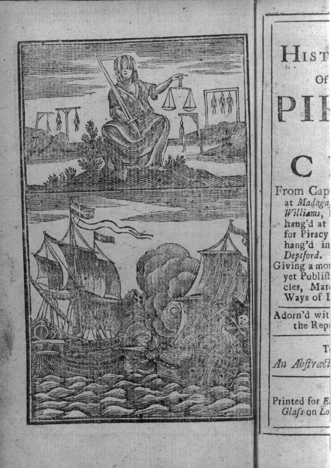
Teacher Toolkit
GIS toolkit - free tools we can pull into class
In-build: our own interactive student maps + Google Earth tour
Two planning artifacts in resources/ that aren't shipped yet but are locked-in directions for the unit:
- Leaflet lesson scaffold (
resources/leaflet-middle-school-gis-whydah-lesson.md) — five-activity arc using Leaflet (~42 KB, MIT) + Leaflet-Geoman: orient the Atlantic, plot the Whydah's route, place the wreck (41.891°N, 69.957°W), simulate Clifford's grid-search excavation, synthesize student evidence as a GeoJSON-output closing activity. Locked technical decision: Leaflet, not MapLibre/Cesium/Felt. Ready to build; suggested order is Activity 3 first as the self-contained template. - KML walkthrough (
resources/whydah-walkthrough.kml) — Google Earth tour scaffold with confidence-tier styling (green/yellow/red + blue for modern sites + red triangle for the wreck). Currently empty — has the document header and styles but no placemarks yet. Needs populating from the dashboard's spatial waypoints (London, Ouidah, Jamaica, Nassau, Cape Cod wreck site, Boston, Charlestown gallows, Wellfleet, Salem, West Yarmouth Whydah Pirate Museum, Real Pirates Salem 285 Derby St).
Shipmap.org (Kiln, 2012)
Animated visualization of one full year of global merchant shipping. Watch container ships, dry bulk, tankers, gas, and vehicles move across the Atlantic. The 2012 data is a snapshot but the patterns are durable.
OpenSeaMap
Free open-source nautical chart - sea marks, harbor info, depth contours, navigational aids. OpenStreetMap's marine layer. Useful for showing students how nautical charts encode depth and hazards differently than road maps.
David Rumsey Historical Map Collection
Stanford's online archive of 100,000+ historical maps - period charts, atlases, globes. The single best free archive of pre-1900 cartography. Includes Moll, Southack-era charts, period Atlantic and Caribbean maps. Built-in Luna Viewer for zoom + compare.
Leventhal Map & Education Center (BPL)
Boston Public Library's map collection - especially strong on New England, Cape Cod, and 18th-century coastal charts. Has a Southack Cape Cod chart and a "X Marks the Spot" article tracing the Whydah cartography story directly.
NOAA Historical Map & Chart Collection
U.S. government archive of 19th-century coastal charts of the U.S. and territories - direct descendants of the Southack tradition. Free, downloadable, mostly NOAA-hosted PDFs. Useful for showing how NOAA still maintains charts of the same waters Southack was mapping in 1717.
Windy.com
Live weather + waves + wind, very visual. Pull up the North Atlantic the morning of S11 and ask "what would today have been like for a 1717 ship?" Run a hypothetical: a 30-knot easterly off Cape Cod is essentially the nor'easter that wrecked the Whydah.
IMB Live Piracy Map
The International Maritime Bureau's Piracy Reporting Centre maintains a live map of every piracy and armed-robbery-at-sea incident reported worldwide. Updated continuously. Singapore Straits was the world's #1 hotspot in 2025 (80 of 137 IMB incidents), far ahead of the Gulf of Guinea (21); Q1 2026 fell to 16 incidents worldwide, the lowest since 1991. Somali piracy resurged in 2024 under cover of Houthi attacks (MV Ruen retaken March 16, 2024) and surged again from late 2025 into 2026 — naval presence deters but no longer fully contains it. The 1717 chokepoints have moved, not gone away.
Modern tools (2026)
MarineTraffic.com — live ship tracking
Our main modern-bridge tool. Free tier shows current positions of commercial ships at sea.
Modern piracy - news, trackers, and organizations
- IMB Live Piracy Map - International Maritime Bureau Piracy Reporting Centre. Live, continuously updated.
- ReCAAP ISC - Asia regional piracy reporting (Singapore Straits is the 2025 hotspot).
- EUNAVFOR Operation Atalanta - EU naval force off Somalia.
- NATO Shipping Centre - merchant shipping coordination + piracy stats.
- IMO (International Maritime Organization) - UN maritime regulatory body.
- gCaptain - piracy section - the best ongoing news source.
- USNI News - US Naval Institute, strong coverage of military responses.
- Center for International Maritime Security (CIMSEC) - analysis and policy.
Recent incidents in modern piracy
- 2024 Ruen rescue (Arabian Sea) - Indian Navy commandos retook the bulk carrier Ruen from Somali pirates in an airborne raid (March 16, 2024). Concrete modern parallel to Bellamy-era boarding tactics, with helicopters instead of cutlasses.
- 2024–2026 Somali piracy resurgence - Houthi attacks on Red Sea shipping created cover for a Somali piracy resurgence after years of decline; it surged again from late 2025 into 2026 (Hellas Aphrodite hijacked Nov 2025; multiple simultaneous incidents tracked by EUNAVFOR in spring 2026).
- 2025 Singapore Straits #1 hotspot - the world's busiest chokepoint became the busiest piracy zone, surpassing the Gulf of Guinea and Somalia.
- 2026 Q1 decline - early 2026 numbers show a sharp drop from 2025 peaks (16 incidents worldwide, lowest since 1991). The pattern is cyclical, not a story of progress.